Sunday, November 3, 2013

Blockhaus and Monte Cavallo, October 21, 2013, Parco Nazionale della Maiella

K on the P trail to Blockhaus
This short, high elevation hike beginning at La Maielletta - a ski area on the north end of the Amaro Range - allowed us to experience two peaks on the Club di 2000m list without having to undertake a big uphill day. But since you have to drive up all that elevation, it took forever to drive to La Maielletta from Sulmona.


From the parking area at La Maielletta (which doubles as massive antenna complex serving the surrounding area), we headed up an older, poorly maintained auto road that a sign said was only for persons with disabilities and emergencies. At points, you can leave the auto road and follow a faint, poorly marked track through open meadows. But the gist is to get to the point that the auto road ends at a small parking area. From here, a short, paved path leads past park benches to a covered Madonna statue and a sign marking this as the P trail to Monte Amaro.


From the Madonna statue, it is steeply up through squat pine trees to the summit of Blockhaus - a distinctive, flat-topped peak containing the remains of a "block house" fort. Alternately, you can skip the summit by following another trail from the Madonna shrine that skirts the north edge of the summit and rejoins the trail down from the ruins on the opposite side.


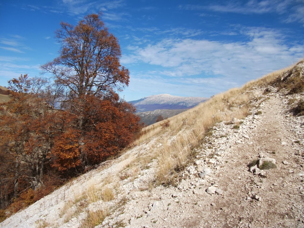
Unlike the bright blue, cloudless skies that we'd been having all week, this hike saw fast moving clouds one minute and mostly sunny skies the next. As the trail followed a ridge line around 7,000 feet in elevation, any openings in the clouds meant amazing vistas all the way to the Adriatic Sea.


The alternating clouds and sun made for a pretty eerie experience. At times, we could only see a few feet ahead as we made our way along the ridge to Monte Cavallo. At first, we thought that this rocky point was the summit...


... and the outdated signs didn't help much with way finding either. But once I brought out the map, it was easy to determine that the summit actually sat a little further along the trail and off to the west. The trail that we were following didn't actually go there.


A short bush whack through small pines revealed a sizable cairn with a stick jammed into the top. Monte Cavallo at last! In this view to the north when the fog had lifted, Blockhaus can be seen in the background. We found a great lunch spot nearby and enjoyed a long, peaceful break at what seemed the top of the world.


Though a pretty cool hike, the highlight of the day came on our drive back down from La Maielletta when we spent a good 15 minutes trying to get through a shepherd's flock that had chosen the auto road as its means of travel. That's driving in the Abruzzo for you.

Peaks: Block Haus and Monte Cavallo
Elevation: 2140 meters (7,020 feet) and 2171 meters (7122 feet)
Distance: 8.5 km (5 miles) round trip, out and back
Route: S trail to Monte Amaro
Conditions: Fog, 60 degrees F


Saturday, November 2, 2013

Monte Mileto 2 (loop), October 20, 2013, Parco Nazionale della Maiella

Perched high above the village of Pacentro and overlooking the valley surrounding Sulmona, Monte Mileto is one of the most accessible high peaks of the Maiella's Morrone mountain range. We had climbed it as a half-day hike in moderately cloudy, windy weather once before, but decided to do it again on what was an absolutely gorgeous autumn day.


From the restaurant at the Passo San Leonardo ski area (where signs say "private parking" but everyone parks there anyway), we followed a faint track from the right side of the restaurant on a diagonal up to the tree line. Once in the forest, the track intersects with the well-marked Q3 trail which goes from Pacentro to Monte Morrone. Turning right on the Q5, the trail winds up through wooded switchbacks and soon opens onto a small meadow. Here, it is important to look out to the left for the Q4 which you take to the Mileto summit. It's easy to miss.


The Q4 is an easy trail to climb as it follows a 4x4 road much of the way up. Starting in the trees and then emerging into open space with wide open views into the Maiella park below, the only challenging section is a narrow, steep track along loose scree when the trail departs the 4x4 trail and skirts the edge of the mountainside.


Eventually, the well-marked trail turns to the northwest and off of the 4x4 track. From here, cairns lead over two false summits before reaching Mileto.


We recognized the true summit from the year before, but I can see how it might be difficult for first time trekkers to figure it out. Having no summit cross, plaque, or wooden sign, the only way to know you are at the top is to have tracked your path on a topographic map or find the small flat rock on the summit that very faintly marks the name and elevation of the peak. There's also a large cairn on top, but the false summits have them too.


With warm temperatures and little to no wind, the summit also proved a great place for a post-lunch nap.


The other way to know you are on Mileto proper is that you have this view down into a col containing two partially-abandoned rifugio buildings. We decided that this year we would turn the hike into a loop by heading down to the northernmost rifugio and connecting with the Q3 trail, which we could take back to Passo San Leonardo.


The descent to the building took longer than expected - which posed a problem when it became evident that K's paltry half sandwich had provided too few calories to sustain her for the trek. Further, the trail markers are pretty poor requiring use of the building itself as a way finder. At the rifugio, it is fairly easy to find the Q3 - as long as you know that it enters from the southeast.


Almost immediately, the Q3 enters into woods and is tree covered for the entire descent. Following a very moderate but consistent grade, it made for a very nice contrast from the open ascent on the Q4. As it turned out, the ideal route was the loop direction that we had selected. The climb up the Q3, though moderate, would have been an extremely long slog uphill for many hours. It was nice that we had chosen it for the descent instead. Still, several snack breaks were required to make it back to the car... further evidence that a full trail lunch is always necessary in the Abruzz.

Peak: Monte Mileto
Elevation: 1902 meters (6,240 feet)
Route: Loop trail, Q4 trail from Passo San Leonardo, return on Q3  
Distance: 9.5 km (6 miles) round trip
Conditions: Sunny, 70 degrees F


Friday, November 1, 2013

Valle Gentile, October 19, 2013, Riserva Naturale Regionale Monte Genzana Alto Gizio

A day removed from the trek up Monte Amaro, I needed a hike with the benign name of Valle Gentile, or "gentle valley." I found this loop hike by studying the map of the Monte Genzana Alto Gizio Nature Reserve located just south of Sulmona along the SS 17. Not as heavily used as the region's three national parks, the reserve suffers from faded, sometimes missing, trail markings. On the other hand, it is also always devoid of people.


We parked the car at the trail head for trail 8, located on a dead end road to the west of the SS17 south of Sulmona and near the exit for Rocca Pia. The same road services the trail head for the hike to Monte Rotella. You can barely make out Valle Gentile on the weather beaten sign.


The trail starts off as a 4x4 road that ascends gently and gradually. We soon passed trail 10 entering from the left and continued on to the intersection with trail 9, which we took up and into the valley. There were some weird things along the way, like "no hunting" signs that had been uprooted and thrown into the bushes, discarded ceramic sinks and bathtubs, charred remnants from large bonfires, and stuff hanging from trees...


Like these chains...


Despite the unsettling features, trail 9 soon became incredibly pleasant as it gained elevation slowly over a moderate grade and alternated between tree-covered sections and open meadows with views of Monte Amaro in the distance. Navigation-wise, the only tricky part came where you must switch back at roughly 90 degrees and onto trail 10, which leads up above the trees and into a wide open meadow...


... And the picturesque Fonte della Spina, our picnic spot for the afternoon. Since it was market day, we had bought along a couple panini di porchetta which we had purchased from our favorite vendor, Porchetta Lucchese, the first thing that morning.


After the fonte, trail 10 becomes very hard to find due to the absence of any blazes. I needed the map and compass to follow what was clearly marked as an official trail on my map of the reserve. Going due east, we soon came to Stazze Le Mandrelle - consisting of a small building and spring - but then needed a while to search around for the return route. The key here is to go towards  the lowest point in the meadow northwest of the stazze. Once you reach the lowest point in the meadow and enter into the trees, the trail markers appear.


From here on, trail 10 became well marked and very easy to follow. It descends through the forest the entire way, with a nice section winding through a small gole with tall cliffs on each side. Eventually, it connects with trail 8 - the trail that we came in on - which we took back to the parking area. A great combination of forests and open land with panoramic views covering moderate elevation gain, the valle gentile is definitely on our list for a return visit.