Sunday, September 20, 2020

The Owl, September 18, 2020, Baxter State Park, Maine


View from the Balancing Boulder, The Owl Summit Cone

Katahdin means "Greatest Mountain." But I'm renaming it "Decoy Mountain." We only had one day set aside for hiking in Baxter State Park and it turned out to be a banner, blue bird day of absolutely perfect hiking weather. Since we can't stand being around hoards of people when hiking, we theorized that Katahdin would be a good decoy. Since EVERYONE would be up there, we'd have a neighboring mountain called The Owl all to ourselves.

We were right.

First View of the Owl Summit

We arrived at the gatehouse at 7 a.m. and sat in a jam of 20 or so cars waiting to get inside. We almost turned around in frustration, but stuck in our and got a parking space at Katahdin Stream Campground. We started off on the Hunt Trail to Katahdin and, of course, saw a bunch of hiking parties. But one mile in, the Owl Trail branches off to the north. From that point until the end of the day, we only saw a single hiker.

Topping the Owl

The Owl Trail is an excellent trail leading to an awesome mountain. It starts with a steady climb through a mossy forest along the banks of a small tributary of Katahdin Stream. After crossing it - the last water source - the trail heads up the ridgeline until popping out of the trees below the summit cone, which supposedly resembles the form of a Great Horned Owl. The summit climb first emerges at a precariously balanced boulder, with the first great views of the ridge below and Katahdin to the east. Rock scrambles then bring you out onto a wide open expanses with a large rock cairn. This is the best place for a a long break, but the true summit is a little further on, with no additional gain needed to reach it.

Descending from the Owl Summit

Peak: The Owl
Elevation: 3,736 feet (2,571 feet Gain)
Distance: 7 miles
Route: Out and back, The Owl Trail
Conditions: Sunny, 40 degrees F


Saturday, September 19, 2020

Rainbow Ledges and Loop Trail, September 17, 2020, Debsconeag Lakes Wilderness Area, Maine


The APCs with Katahdin in Distance, from Rainbow Ledges

On a recent long weekend jaunt up to Maine, my brother, nephew and I chose to do a short loop hike in the Debsconeag Lakes Wilderness as a warm up hike before a bigger outing in Baxter State Park. I don't get to Maine too often. But my brother needed to pick up a Grand Laker canoe that he had purchased for restoration and we decided to turn it into a hiking trip. We booked a cabin on South Twin Lake just south of Millinocket as our base of operations.

Dawn at the Cabin on South Twin Lake

The Debsconeag was an appropriate choice for a hiking trip tied to a canoe pickup -- the Indian word means "Carrying Place," a name bestowed on the area because of the many lakes and ponds requiring portages between them. It's a fabulous place to hike, off the beaten path and devoid of the hoards that we expected to see in Baxter State Park the next day. We had the hike pretty much to ourselves with the exception of a couple of campers in the backcountry and a part of three in the parking lot as we were leaving. 

Confusing Trail Sign at Rainbow Pond Parking Area

The trails aren't really named very well and the signage is confusing, but we had the AMC Maine Mountains map and knew how to tackle it. It is basically a loop with an optional out and back spur to Rainbow Pond at the end. We did the hike in a counter clockwise direction, with the first destination being Horserace Pond. The trail has the pleasant sound of Horserace Brook all the way to the pond, which is a spectacular place. We pulled a "leaner" on some slanted boulders on the southern shore for a nice late morning coffee break. 

Horserace Pond

After the pond, the trail makes a long but easy climb to the Rainbow Ledges, which offer great views to Kathadin in the distance and the many water bodies that gave the Debsconeag its name. We took a second break on the ledges and then undertook a long descent back into the valley, happy to have found a lesser trafficked trail that definitely deserves another visit.

Peak: Rainbow Ledges
Elevation: 1,504 feet
Distance: 6 miles
Route: Loop, Horserace Brook Trail; Outlook Trail, Blue Trail
Conditions: Partly sunny, 60 degrees F

Wednesday, September 2, 2020

Street and Nye, Eastern High Peaks, Adirondack Park, September 1, 2020

Mossy Forest on Summit of Street

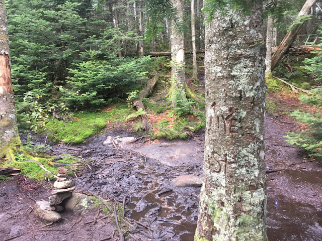
Sometimes, I don't get Adirondack hikers. Tons of trip reports call Street and Nye a "good, bad weather hike." But the same writers also complain about the mud and muck on the unmarked, unmaintained trail that takes you there. 

If you don't like getting your boots dirty, then don't do Street and Nye on a shitty day.

I hadn't planned it that way, but it turned out that the day that I chose to do Street and Nye wouldn't be a banner, blue bird day. It was blustery and slightly overcast with intermittent drizzle. I knew that it would be wet and muddy but just embraced that fact from the get-go. Mud doesn't bother me, nor does a lack of views - that other complaint about Street and Nye. The fun isn't always the destination, it is the trip getting there.
Crossing Indian Brook in Headlamp Light

I set out at 5:30 a.m. and did the first section of the trail around Heart Lake and all the way to the Indian Brook crossing with the light of a headlamp. The brook was at its late summer low levels and the crossing was no problem. The trail from there up to the col between Street and Nye is quite pleasant since you get the sounds of a stream for much of the way. At multiple points, the trail becomes the stream bed and this, I suppose, is part of the reason for its muddy reputation. Although not maintained, the trail is easy to follow if you are paying attention. I repaired a few fallen cairns here and there at the tricky parts. It can be confusing at the brook crossing since there are multiple crossing points and I got off track on the return because of this, but my map and compass quickly fixed the problem.
First views of the day, to the east, from the climb to Street and Nye

At the col, the trail splits in a pleasant break spot marked by a small cairn. I did the longer trek over to Street Mountain first and saved the quick up and back to Nye for last. The trail over to Street is absolutely gorgeous. It was covered in moss and lichen that turned the forest into a sparking green wonderland whenever the sun started to peak through the cloud cover. The wet conditions for which these mountains are known produce a lot of mud and muck, for sure, but it is counterbalanced by the water-loving flora that make this trail so special.
The Trail Split, South to Street, North to Nye

It was a little eerie up top since I was totally along the entire time with the only sounds being the blustery winds whipping through the conifers. I hardly took a break, just hit the peaks, packed up and headed back down. I encountered only six people during my descent and was back to the Loj parking area at 10:30 a.m., for a quick up and back trail time of 5 hours sharp.
Pleasant Forested Summit on Street

My boots were mud encrusted and my pant legs brown and soggy, but I was already planning to make another visit to Street and Nye on a nice weather day. 

It's actually a great hike and deserves better reviews than just "save it for a crappy day."

Peaks: Street and Nye
Elevation: 4,166 and 3,895 feet (2,634 feet Gain)
Distance: 9.1 miles
Route: Out and back
Conditions: Overcast, wind, drizzle, 55 degrees F

Tuesday, September 1, 2020

Sawteeth, Gothics (and Pyramid), August 31, 2020, Eastern High Peaks, Adirondack Park

Lower Ausable Lake from Scenic Trail to Sawteeth

The Sawteeth seem to get zero respect. Most people seem to treat them as an "add on" on rather than a destination, probably because they so easily reached via a short spur from the Weld trail and most hikers just quickly grab the summit as part of a loop over Gothics and Armstrong. And since the views are not the 360 degree ones you get on nearby Pyramid Peak or from the open ridge of Gothics, people seem to disparage the actual Sawteeth summit as "meh." 

But Sawteeth are actually one of the absolute best hikes in all of the Adirondacks if you incorporate the Scenic Trail as part of your itinerary. It's a long, winding, out of the way route that the everyday aspiring 46er won't even consider -- they often seem to be too obsessed with finishing their list as quickly as possible. Fine by me. Means I get one of the best trails in the High Peaks all to myself.

Dam at Lower Ausable Lake, start of A.W. Weld Trail

I pretty much had just that on a beautiful late summer day with little cloud cover and no wind - the kind of day when the parking lot at the AMR is filled up by 6 a.m. I decided to do a Sawteeth loop hike with an out and back to Pyramid and Gothics and got to the parking lot by 5:30 a.m., geared up, and was on the trail at 5:45 sharp. I used the Lake Road to do easy-on-the-legs miles up to the dam. The AMR gatekeeper passed me twice on a golf cart, once going up, and once going down, sharing a friendly "You have it all to yourself!" shout out to me as he headed back to his hut.

View back to Pyramid Peak from Gothics Shoulder

He was right. I didn't see a soul for hours. I was alone for the entire ascent up the Weld Trail, including the always-popular Rainbow Falls. I was alone during a long break on the summit of Pyramid Peak, enjoying what some say is the greatest view in all of the ADKs. I then did a quick out and back over to the summit of Gothics and had that entire jaunt, as well as another short break on the Gothics summit boulder, all to myself as well. I finally saw the first hikers of the day when I retraced my route back to Pyramid Peak. Several people had come up in the time I was over at Gothics and were taking a break on the summit.

View of Marcy from Sawteeth Summit

From there, I headed back down to the col between Pyramid and Sawteeth and made the climb to the Sawteeth summit. There, I ran into a couple of aspiring 46ers and their border collie. They were friendly and quick to share the fact that they weren't  impressed with the summit. We talked for 5-10 minutes and then they started out on their long trek back to the Garden parking area, cursing the NO DOGS ALLOWED rule that prevented them from coming in from the AMR.

Ladder on Scenic Trail

But the absolute best part of the day was the amazing descent from Sawteeth via the Scenic Trail. This trail goes right through the "teeth," those rocky vertical slabs that you can see from various points in the valley that give the peak its name. The trail is pretty much all vertical, with wooden ladders needed to negotiate some particularly harrowing precipices. All along the way, you come to various rocky outcroppings that overlook Lower Ausable Lake. At the first outlook on the descent, the lake is straight down, more than 1,000 feet below -- A pretty daunting sight when you know that the trail you are on is going to take you there. I took several breaks along the way, admiring the views of the lake from the various outlook points, and even had the chance to listen to the calls of a common loon as I got closer to the water's edge. Once it makes its way down to the lake, the trail pleasantly meanders right along the water's edge and back to the dam. 

Although it was early afternoon on an absolutely perfect hiking day in late summer, I encountered only one hiker on the Scenic Trail in the three miles between the summit and the dam. 

If ever there was an overlooked, "sleeper" hike in the ADK, the Scenic Trail is it.

Peaks: Gothics and Sawteeth (via Pyramid)
Elevation: 4,736 and 4,100 feet (4,000 feet Gain)
Distance: 15.2 miles round trip in 9 hours 
Route: Loop combined with out-and-back, Lake Road, to A.W. Weld Trail to Pyramid and Gothics, reverse course to Trail 37 to Sawteeth, to Scenic Trail, to Lake Road.
Conditions: Sunny, 75 degrees F