Friday, October 17, 2025

Whiteface Mountain, October 17, 2025, McKenzie Mountain Wilderness, Adirondack Park

First light and waning crescent moon from Marble Mountain overlook

Everyone knows the rules for High Peaks hiking. Make sure to pack your "Essential Ten." Leave your planned route and ETA with someone back home. Always maintain three points of contact on ladders. Bury human waste in a hole six to eight inches deep, off the trail, and away from water sources. Today, I came up with a new one. Never watch a musical-turned-motion picture the night before a solo 46er hike. I did just that before a recent hike up Whiteface Mountain and couldn't shake Gee Officer Krupke, America, and other catchy tunes from West Side Story the entire six-hour-long morning on the trail. Particularly embarrassing, on the descent, was when a hiking party rounded a bend to catch my vocalization of the most earworm West Side Story song of all -- I Feel Pretty. Oh well, Muhammad Ali wasn't afraid to say it.

Approach to Whiteface summit buildings

Mount Whiteface looms large over the towns of Wilmington and Jay, our go-to base of operations whenever we visit the Adirondacks. You can see Whiteface from the pond loop hike in the cabin subdivision where we often stay. You can see it from two of our favorite hikes in the area, the Bluffs at Silver Lake and Cobble Lookout. And it is the prominent landmark in views from Catamount, Clark Mountain, Silver Lake Mountain and other small peak hikes in the Wilmington/Jay region. Yet in all these years of hiking in this part of the Adirondacks, I still had never visited its summit... despite having already hiked up to its nearby sister peak, Mount Esther.

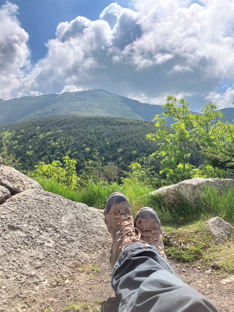
View to the Northeast from Whiteface 

So, on the last day of a recent weeklong stay in Jay, I decided to use the blue bird weather forecast of sunny skies, light wind, and cold, yet still comfortable, autumn temps to finally visit Whiteface. I set off on the Marble Mountain Trail from the ASRC at 6 a.m. sharp, choosing this route because I wanted to get to the mountain's overlook point with plenty of time to watch the sun come up. It only took about 30 minutes to navigate the straight but steep scree-covered route up to the overlook with a headlamp. I then camped out for 45 minutes or so to watch the pitch black of night turn to first light and, eventually, a beautiful sunrise. It was neat.

Rockwell Kent-ing it on Whiteface pinnacle

Once on the Wilmington Trail, it is a fairly straightforward climb covering a lot of elevation over a short distance, kind of like Giant Mountain in the ADK and many of the 4,000 footers of the White Mountains. I was glad to do this hike a few days after the memorial highway had closed for the season since I was the first hiker to the top and had the entire summit all to myself to admire the 360 degree panorama and explore the eerily quiet buildings. A week earlier and I am sure that the place would have been mobbed. I didn't start encountering other hikers until I was about 1/3 of the way back down the mountain, but all of them were amiable, chatty folks clearly enjoying a beautiful day out so I didn't much mind. I was quite content that I had plenty of alone time on an otherwise ever-busy peak.

Oh, I almost forgot. Mount Whiteface makes it 46/46 ADK High Peaks hiked.

And there was much rejoicing. Yaaaay.

Peak: Whiteface Mountain
Elevation: 4,867 feet (Gain: 3,143 feet)
Distance: 7.2 miles
Route: Out and back, Marble Mountain Trail to Wilmington Trail 
Conditions: Sunny, 30 degrees F

Wednesday, October 15, 2025

Couchsachraga, Panther, and Santanoni Peaks, October 12, 2025, Western High Peaks, Adirondack Park

Amazing High Peaks panorama from Santanoni... view to the east of Algonquin, Iroquois, Colden and its slides, Marcy, Skylight, Haystack, Allen, Nippletop, etc., Henderson Mountain in foreground and Mt. Adams mid-distance on right

For a couple of reasons, I'd always planned to do the three 46ers in the Santanoni Range as multiple trips. For one, I knew that the trifecta was going to be a really tough hike with long mileage, high elevation gain, numerous ups and downs, difficult terrain, and a lenghy out and back to an extremely remote peak on the other side of a false summit and notoriously difficult-to-cross boggy area. Breaking it up into several comparatively-easier hikes seemed to make more sense. Another reason was more philosophical than physical. Seemingly out of nowhere, I found myself at a point only 4 peaks away from having hiked all 46 High Peaks of the ADK. Some people rush to finish the list. I didn't want it to end. Turning the Santanonis into several hikes would allow the fun to live on. 

First views of the day at the precipice above Bradley Pond

When the day that I set aside to explore the range finally came, however, the conditions were so perfect that I decided I was ready for a big day and set out to visit all three as a single hike. Since the trail head in Tahawus was 1 1/2 hours away, one way, I got up at 4 a.m. in order to make it there by 6:30 and was geared up and on the trail to Bradley Pond at 6:45 sharp. I only needed headlamp and bear bell for about 15 minutes until sunrise. It was great to have the early morning trail to myself all the way to the pond.

"Times Square" base camp for the day

On the other side of Bradley Pond, the herd path along Panther Brook rises steeply to a first view of the day overlooking the valley and the pond down below. Here, I overtook a pair of friendly hikers who had started at 6 a.m. and were doing all three peaks as well. I was surprised to see them at this location as most hikers tend to do Santanoni first via the Express. Instead, my plan called for a counter clockwise route. I wanted to get the long slog of Couchsachraga out of the way first. The psychological boost of still having a couple of peaks with nice views as motivation, I reasoned, would help me on the long, two-hour out-and-back to a lower, wooded, and less interesting peak. 

Yes, there is a view from Couchie!

So that's what I did. Once at the height of land at the top of the Panther Brook herd path, I stowed my heavy pack at Times Square - the unofficial name of the trail nexus - and began the trek to Couchsachraga with just a  summit bag. I knew that it would be long, but this descent goes on and on and on and on. Then it goes up, then down over a false summit before finally dropping steeply to the infamous bog. At this point, I encountered a pair of hikers pushing out of the woods to the right (north) of the bog and they informed me that this was the best way to go. Indeed, following a faint bushwhack through the saplings here allows for the complete circumnavigation of the dreaded bog. Glad to have avoided the wet work, I started climbing again and finally made it up to Couchsachraga. People always complain that it is a waste of a hike because the peak offers no views. That's true, to a point. The summit proper is just a small wooded clearing. But there is actually a very nice overlook with a wide view back to Santanoni just to the east of the summit. After tagging the sign, I backtracked to this point and stopped here to admire those very views. 

Views from Panther Peak to Santanoni (left) and to Couchsachraga and its false summit (right)

It was on the long return from Couchsachraga to Times Square that I encountered the bulk of the hikers who I would see that day, about ten or so, who had all started after me and done Santanoni first. This was promising, I thought, because it would mean that I would probably have Santa all to myself later in the day. I hit Panther next, which involved backtracking the way I had come in, but I stuck with the summit bag and that made for a quick and easy up and back. The views on Panther are great. It was neat to look down on Couchsachraga and its false summit knowing that I had already done them. Phew! The view to Santanoni, the biggest of these three peaks, is spectacular as well, and for me was also a little daunting knowing that I was heading there next. I chatted with two solo hikers hanging out on the summit and then moved out for the last climb of the day.

Fresh socks as a reward for the climb to Santanoni, view to Panther Peak

As I had hoped, I did get to have Santanoni Peak all to myself. After visiting the summit proper, I returned to a small clearing with a vantage point back to Panther and took a long break to rest, eat, drink and change socks - my go-to late-day psychological boost to close out the last miles of a long hike in the ADK. Everybody raves about the view from the open slabs on Panther, but the best views are to be had on Santanoni. Looking east from one of the overlooks, a full High Peaks panorama unfolds before you... easily one of the very best vista points of all the 46ers. It took a while but eventually I got around to starting my descent on the Santa Express. It was rough, but pretty straightforward technically until I got to the top of the so-called "Hillary Step," a super steep, forty-foot-tall open rock slab. When ascending this trail, I found out later, there is a clearly discernable reroute which bypasses the slab itself. But I entirely missed this option on the descent and had to take a few minutes to contemplate the safest route down. I ended up just tossing my poles and pack off the ledge and climbing down the center of the slab using the cracks and fissures as hand holds. Channeling the inner Alex Honnold? Not.

Looking back up the Hillary Step on the Santa Express

Once off the Express, the Bradley Pond Trail seemed to go on forever but I finally made it back to the parking area around 4 p.m. for a total trail time of about 9 1/2 hours. I had scraped shins, cut hands, bruised shoulder, ripped pants, saturated boots, and aching legs. All in all, doing all three peaks in the Santanoni Range as a day hike lived up to my expectations as a real beast.

Should have split 'em up.

Peaks: Couchsachraga Peak, Panther Peak, and Santanoni Peak
Elevation: 3,820 feet, 4,442 feet, 4,026 feet, 4,607 feet (Gain: 4,820 feet)
Distance: 15 miles roundtrip
Route: Loop, Bradley Pond Trail to Panther Brook herd path, to Times Square, to Couchsachraga herd path, back to Times Square, to Panther Peak herd path, back to Times Square, to Santanoni herd path to Santanoni Express, to Bradley Pond Trail
Conditions: Mostly sunny, 35 degrees F
Notable Flora/Fauna: Nothing of note in the so-called "dismal wilderness" 


Saturday, September 20, 2025

Allen Mountain, September 20, 2025, High Peaks Wilderness, Adirondack Park

Misty dawn on Lake Sally

Although I didn't plan on it until the last minute, I decided to do the super long hike to Allen Mountain based on the fact that the region had not seen much rain in the past few months and the forecast called for perfect autumn hiking conditions. I anticipated that the Opalescent River would be low enough to rock hop when it often runs so high that hikers need to lug Tevas or other water shoes and actually wade across. The trail to Allen Mountain is muddy, like all ADK High Peaks, so I figured on less mud due to the lack or rain. More importantly, I expected that the dreaded "red slime" on the rocky slabs up Allen migbt be slightly dried up, making that notoriously tough ascent a little bit easier. All of these elements of the hike that I had anticpated turned out to be true. The one thing that I didn't anticipate was having a hiking partner for almost all of the long, 11-hour, 18-mile day.

Frosty morning and autumn colors on East River Trail

I never hike the High Peaks on Saturdays due to the trail traffic, but figured that I could make an exception on a challenging and remote peak like Allen since it is much less popular than almost any other High Peak. I still made sure to head out early and got one of the last spots in the East River Trail parking lot at around 5:45 a.m., well before sunrise. Several hiking parties looked to be waiting for first light to start out, but I put on my headlamp and hit the trail in the pitch black of pre-dawn at 6 a.m. sharp. The first part of the trail is flat and easy but you still need to watch carefully for rocks and roots. Head down with the light on the trail, I didn't see much of anything until reaching the shore of Lake Sally and took a few minutes to watch the mist rising above it by the dawn's early light. It was a peaceful, pleasant site.

In the middle of the low flow Opalescent River

About 2 hours in, after the expected super-easy crossing of the dried up Opalescent River, I caught up to a hiker and greeted him with a comment of starting out in a headlamp. John was a friendly, gregarious fellow and we chatted for a few minutes before he hit the trail again. I needed to fix my boots and take a water break, but sure enough I caught up with him again about 20 minutes later. This time, he invited me to hike with him. What the hell, I thought. Allen is a long, grueling slog of a hike and it might be a nice change of pace to join a fellow hiker for a while. I figured that maybe we'd hike together for a few hours and then I'd break off and have my alone time later in the day. But in the end we spent the next 9 hours on the trail together. Good times.

John ascending the slabs, view west to Mt. Adams and the Santanoni Range

Eventually, the East River Trail heads north towards the Great Range and one must find and turn due east on the unmaintained herd path to Allen. There's no sign, but if you've done your homework it is easy enough to locate. The herd path continues on the flat for a while, then drops down in elevation slightly before the ascent begins as a comfortable incline through pleasant woods followed by steep climbing after the Allen Brook waterfall. Here one finds the dreaded red slime slabs for which Allen is known, and often reviled. There were definitely some hidden slime patches and I slipped and scraped my knee when socializing and therefore not paying close enough attention, lamenting that such a thing never happened to me when hiking solo. But the red slime was not that bad and the slabs were very dry and easy to cross. At one point, the trail becomes unclear and the ideal route is to hug the treeline to the left. We followed another hiker to the right and found ourselves needing to traverse the slab in a very precarious spot with a steep drop at our backs. We made it, but John's comment "I don't feel good about this," spoken while we traversed the slab, became the hilarious catch phrase of the day.

View to Marcy, Skylight, Haystack and Little Haystack from Allen east lookout

At the summit, we encounted a small group of 10 or so hikers strewn out at the summit sign and various lookout points. It was a very nice bunch of friendly, talkative folks and we took a quick lunch break together and conversed about our High Peak adventures. With blue skies, comfortable temps and no wind up top, I would have normally spent more time at the summit but my hiking buddy was rearing to go again in no time. This could have been my out to finish the day alone, but I was enjoying the companionship and we set out together to make a careful descent of the slabs and the long return to the parking lot, arriving back at the trail head at 5 p.m. All in all, Allen was a fun but grueling, 11 hour day covering 18+ miles. As we signed out at the trail register, John reminded me that this was his second trip up Allen, a peak that many 46ers lament as one of their least favorites but that he liked so much he wanted to pay another visit.

You know what? I would do it again, too.

Peak: Allen Mountain
Elevation: 4,340 feet (Gain: 3,740 feet)
Distance: 18 miles
Route: Out and back, East River Trail to Allen Mountain herd path
Conditions: Sunny, 40 degrees F
Notable Flora/Fauna: Hairy Woodpecker, Ruby-Crowned Kinglet

Saturday, September 13, 2025

Mount Washington, September 9, 2025, Presidential Range, White Mountain National Forest

View to the Lion Head from Lawn Cut Off

Over the last few years, I've been revisiting the highest of the Presidential peaks via some of their lesser-known, lesser-used trails. Doing this in September, not in the busy summer months, has meant that I have had the approaches to Jefferson, Adams and Madison pretty much all to myself, something totally unheard of on the most direct-to-summit trails. This year, I wanted to see if I could also have a solo trail experience on my way to the most popular peak in the Whites -- Mount Washington.

Glen Boulder Approach

On a picture perfect hiking day with no clouds, no wind and cool, comfortable temperatures, I decided on a looping approach to the summit via the Glen Boulder Trail. The conditions would definitely bring out the hikers, but I surmised that few would take this longer, meandering route. I parked at the trail head for the Direttissima Trail located just south of Joe Dodge Lodge and was happy to see that I was the only car in the lot. Direttissima means "very direct" in Italian and is used quite often as a trail name in Italy, always signififying the most direct approach to a summit. On paper, the White Mountain Direttissima is indeed a straight shot trail meant to connect Joe Dodge Lodge with the Glen Boulder Trail, thereby allowing hikers to avoid a road walk on the highway. But straight doesn't mean easy. There are steep ups and downs the entire way. 

View to Mount Washington from Davis Path

Once on Glen Boulder Trail, the route climbs steeply and quickly out of the tree line and one is treated to views of the rugged, rocky terrain of Mount Washington and wide, sweeping views in all directions -- a visual feast that continues for hours. I spotted a soaring Peregrine Falcon here, which was pretty neat, and then paused in the shadow of the massive Glen Boulder for a short break to admire the views to the northeast of the Carters and Wildcats. The panoramic views on this trail are amazing and, as expected, nobody was on it. The trail even offers a reliable and picturesque spring, accessible down a well marked spur trail leading to a small, wooded glen. Knowing that I would have the summit buildings as a fill-up spot, I wasn't carrying much with me so I took advantage of the spring and filled up a Nalgene.

Appropriate Hang Out for a Mountain Dog

Glen Boulder Trail eventually connects to the Davis Path, which I took as far as the Lawn Cut Off leading north to the upper reaches of Tuckerman Ravine Trail. They call these wide open boulder fields above treeline "Lawns" and the route across this lawn was nothing but big rock hopping. At the intersection with Tuckerman Ravine Trail, I started to see the first other hikers of the day and then pressed on for more bouldering up to the summit. There, I encountered the usual Mount Washington madness -- lines of cars pulling into the parking lots from the autoroad, passenger vans of sightseers loading and unloading, and the whistle of the Cog Railroad as it came and left. I took my lunch break at the picnic table just below to the Tip Top House. There was scarcely a breeze on the summit, a rare thing indeed, so I took my time enjoying the views from various points. Due to the crowds, I didn't even bother going up to touch the summit marker.

View to the South from Top of Tuckerman Ravine Trail

I had designs on possibly continuing my loop hike over to Ball Crag and then down to the Alpine Garden and a descent via the Lion Head. My fatigue level said otherwise and I opted for a simple (relatively) descent all the way down the Tuckerman Ravine Trail. I stopped to chat with a few late departing hikers who were on their way up, but it was a remarkably quiet and lonely day on the most popular trail to Washington. Once at Joe Dodge Lodge, I grabbed a seat on one of the only free benches to have a quick rest before the short spur trail back to the Direttissima that leaves from the southernmost end of the lodge parking lot. Glancing down at the Suunto heart monitor watch connected to a chest strap that I had decided to wear on the hike, I saw that it read 3,716 calories burned. Marathon runners burn around 2,600-3,000.

Mount Washington ain't easy.

Peak: Mount Washington
Elevation: 6,288 feet (Gain: 4,819 feet)
Distance: 9.33 miles roundtrip
Route: Loop, The Direttissima to Glen Boulder Trail to Davis Path to Lawn Cut Off to Tuckerman Ravine Trail 
Conditions: Sunny, 35 degrees F
Notable Flora/Fauna: Peregrine Falcon, mountain cranberries

Wednesday, August 6, 2025

Mount Haystack, August 1, 2025, Eastern High Peaks, Adirondack Park

View to Gothics from Mount Haystack 

It's a five hour drive from our house to Keene Valley, "Home of the High Peaks." For this reason, we usually plan one or two week-long cabin stays in the ADK every year in order to get in as many hikes as we can. This tends to work better than just going up for long weekends, which can seem like you are spending more time in the car than on the trail. Having a full week also gives me a chance to monitor the weather and use certain conditions for 46er hikes and other conditions for shorter, lower elevation hikes. On a recent Saturday to Saturday stay, the weather finally turned perfect for high elevation hiking on our very last day. The problem -- I had already done a four-peak, 13-mile hike of Hough, South Dix, Grace and Macomb earlier in the week, plus early morning and midday hikes with K and R. All told, I had racked up over 35 miles and 7,000 feet of elevation gain in the first five days of our trip. I was tired and sore and found myself questioning if I had enough in the tank for one more peak.

All quiet at the JBL at 7 a.m.

Sometimes, one needs a bit of added motivation for a big day. For me, it came when I checked the calendar and saw that the date of that Friday was August 1, my dad's birthday. Nobody contributed more to me becoming a hiker than my dad. As soon as we could walk, my younger brother and I were out in the woods, usually with dad, sometimes on our own, exploring existing trails and charting new ones. Our first peak bagging experiences, it could be said, came at ages 6 and 4 on Marvin Mountain and Mount Nimham (my brother will get the joke 🤣). A city kid from New York, dad went all-in with nature in the 1970s, buying our childhood house in the woods upstate and joining his brother-in-law on hiking trips in places as far afield as New England and the Southwest. His love of hiking and the outdoors was infectious, and we learned to appreciate nature as he did. Dad died way back in 2004. I have no doubt that if he were still with us, he'd still be hitting the trails at age 83.

30-year-old NPC Sr., Appalachian Trail, Mount Cube, New Hampshire, 1973

Realizing that August 1, his birthday, was coinciding with one of our weeks in the ADK and was going to be a gorgeous, blue bird weather day, I took it as a collective sign that I needed to forget about fatigue and finally do a peak that had long been on my bucket list -- Mount Haystack. I'd had the route all planned out for some time. It would be a straight shot, out and back, from The Garden in Keene Valley via the Phelps Trail. I like hiking out of the Garden for one main reason -- Johns Brook Lodge. The presence of the lodge at a point 3.5 miles in means that you can start your day with empty water bottles and just fill up there. Saving that water weight makes for a quick and easy start to the day over comparatively easy terrain. The lodge also gives you a place to refill and rest on the way out. The hike up and back to Haystack is around 16 miles round trip, but if you don't count the 7 miles to and from the lodge, it's only a 9 mile hike. Piece of cake. At least that's what I told myself.

Slant Rock on Phelps Trail

Pulling into the Garden at 5:45 a.m., I got one of the last two parking spots (Phew!) and was on the trail at 6 a.m. sharp. As expected, I made quick work of the first leg and was at the JBL in just over an hour. After a second breakfast and water fill-up, I hit the trail again, this time with trekking poles since the route starts its rocky, root-ridden ascent here. I was pleased to have the Phelps Trail almost all to myself and only encountered three other hikers before reaching my turnoff to the State Range Trail. The highights in this section are a long, picturesque climb along a wooded spine-like ridge called a "Hogback," Bushnell Falls (accessible via a short spur), and Slant Rock, a huge shelter-affording boulder that served as a historical camping site. Almost immediately after the turn-off from Phelps Trail, the State Range Trail goes almost straight up, requiring the stowing of trekking poles and hand-over-hand climbing and root grabbing the whole way up. This steep climb brings you to the top of an unmarked mini-peak known as "Horse Hill," which has a rocky outcropping offering a striking view to the south of both Little Haystack and Haystack.

View to Little Haystack and Haystack from Horse Hill

From there, it is down and up, then down and up again to the summit of Mount Haystack. The hiking here is largely on open rocks, above tree line, with panoramic 360 views of the entire High Peaks Wilderness and beyond. There are absolutely no signs of civilization for as far as the eye can see. No roads, no towns, no summer homes, no power lines, no windmills. Nothing but nature. I spent a good amount of time admiring the vistas in all directions, picking out various peaks that I had visited in the past, and chatting with some of the many hikers who were doing the same. That's right. The peace and quiet of the trail ended up top since there were numerous groups and individuals coming and going from the Haystack summit. But I wouldn't have expected anything less.

On Little Haystack

I did want some alone time, so I backtracked to the less-busy summit of Little Haystack and took a longer break to look at the mountains and alpine vegetation some more and reflect on how great it is that my home state had the foresight to save this chunk of wilderness for future generations to enjoy. Most other hikers were planning to return via the State Range Trail over Basin and Saddleback. This worked out great for me as I again had the Phelps Trail all to myself for the long return to the JBL. As planned, I stopped there to finish up my food and fill up a 1/2 liter Nalgene for the last 3.5 miles back to the Garden.

I'm not gonna lie. I was hurting at the end of this epic 16+ miles of 4,000+ elevation gain over 9+ hours of trail time to the the third highest peak in New York State.

Now can I have a rest day?

Peak: Mount Haystack
Elevation: 4,915 feet (Gain: 4,443 feet)
Distance: 16.3 miles roundtrip
Route: Up and back, Phelps Trail to State Range Trail to Haystack Trail to State Range Trail to Phelps Trail
Conditions: Mostly sunny, 65 degrees F
Notable Flora/Fauna: American Goshawk, Boreal Chickadee

Hough Peak, South Dix, Grace Peak and Macomb Mountain, July 28, 2025, Dix Mountain Wilderness, Adirondack Park

Elk Lake from Macomb Mountain Summit

I have never been in any rush to complete all 46 of the ADK high peaks. I've done ones that I like more than once. I spend lots of time on lower-elevation, but equally-rewarding, lower summits. And I consciously choose to avoid a 46er hike if my free day for hiking happens to fall on a day when I know there will be too much pressure. I've also shied away from doing too many hikes that tackle a whole bunch of peaks in one trip and always do them as single day, not overnight jaunts. You don't win the prize for fastest-to-46er that way.

First Glimpse of Hough from Lillian Brook Trail

In 2024, I didn't do a single ADK 46er in the entire calendar year since I spent more hiking time in the White Mountains. For this reason, I decided that I would make up for a big goose egg in 24 by breaking from tradition and doing a single day, multi-peak hike in 25. The Dix Range gives you that option, and on a hot and humid late-July weekday, I planned to do Hough, South Dix, Grace Peak, and Macomb Mountain, in that order, from Elk Lake.

The Beckhorn from Hough Peak

This isn't the traditional way to hit these peaks. Most people tend to go up the west side of Macomb Mountain via the Macomb Slide first, then along the ridge to South Dix and Grace, followed by a backtrack to Hough (and maybe then on to the Beckhorn and Dix). I wanted to avoid the summer crowds so pieced together my own route using the Lillian Brook Trail to access the high elevation and hitting Hough first. This, I reasoned, would also allow me to take my full pack all the way to the Lillian Brook Cut-off, where I could stow it in favor of a lighter summit bag to hit the four peaks, and then, after an out-and-back to Macomb, loop down and back to my pack via the Lillian Brook Cut-off Trail.

View to the West from Gracie to South Dix and Macomb Mountain

The plan was solid and worked a treat, but the conditions made for a much longer and more grueling journey than I had anticipated. First, the trails to these peaks are not official trails, but unmaintained "herd paths." Unmaintained is an understatement. We're talking blow downs galore. It took ages of extra time to clamber over and around the hundreds of tree falls, especially on the disastrous Lillian Brook Cut-off Trail. Secondly, the weather. Near 100% humidity, super warm temps, absolutely no wind even on the high points and the haze of Canada wildfires all contributed equally to an uncomfortable, 10-hour day of soupy slogging over 13+ miles in sweat-soaked clothes.

Nevertheless, the trails were lonely and peaceful, the forests beautiful, and I was pleased to have several of the summits all to myself to admire the amazing views, especially those to the west from the open rocks on Grace Peak and the wide panorama of Elk Lake from Macomb. I'll definitely be back. 

Just not in July.

Peaks: Hough Peak, South Dix, Grace Peak and Macomb Mountain
Elevation: 4,400 feet, 4,075 feet, 4,026 feet, 4,383 feet (Gain: 4,032 feet)
Distance: 13.9 miles roundtrip
Route: Lolipop loop with two out-and-backs (Hunter Pass Trail to Lillian Brook Trail to Dix Range Trail to Grace Peak Trail to Dix Range Trail to Lillian Brook Cut-off Trail to Lillian Brook Trail to Hunter Pass Trail)
Conditions: Mostly sunny, humid, hazy, 80 degrees F
Notable Flora/Fauna: White-Throated Sparrow, Black and White Warbler

Tuesday, June 24, 2025

Mount Lafayette and Mount Lincoln, June 16, 2025, Franconia Range, White Mountain National Forest

View to the South from Franconia Ridge Trail

I've been to Mt. Lafayette many times, with several particularly-memorable hikes being up Falling Waters Trail and another one being a longer loop via the lesser-used Skookumchuck Trail. Since Lafayette is my favorite of the 4,000 Footers, I was excited to find out that both of my nephews had named it as the hike of choice in advance of our most recent trip to the White Mountains. That decision made, all that we needed was a decent forecast. As it turned out we got just that. 

All Smiles on Agony Ridge

It was actually quite lucky that we had such a perfect day - 60s in the valley, 40s up top, no precipiation, and summits in the clear with light and variable winds. The day before our hike was rainy, as was the day after, and we just barely got ahead of a heat and humidity wave that arrived 48 hours later and lasted for a week. The only downside to a good forecast amid a week of unsettled weather is the chance of heavy trail traffic on the most popular peaks. So we resolved to get out as early as possible and were on the trail at 7 a.m. sharp, my brother and I both grumbling that our preferred start time would have been 5 a.m.

View to Lafayette Summit from Greenleaf Hut Nap Spot

We made quick work of the lower, forested reaches of Old Bridle Path and took our first break at one of the numerous rocky ledges along so-called "Agony Ridge" that offer amazing views up to Lafayette and the entire Franconia Range. All of my White Mountain 4,000-Footer hikes with the nephews wind up having catch phrases, which have ranged from the humorous "can you cut the mustard?" to the sullen "this sucks," depending on their moods. For this hike, it was simply "What a Vista!" 

Franconia Ridge Trail, View to the South

What a vista is right. This hike has nothing but great views. The dramatic perspectives up to the top of the ridge as you ascend are only the first. Greenleaf Hut, where we took a break and filled up our water bottles, sits on a prominent pondside point that affords a great view to Lafayette's looming summit cone. After climbing Laffy, we headed south along the Franconia Ridge Trail to Mount Lincoln. This entire route, of course, has amazing views in all directions, making it one of the most popular trails in the White Mountains. At the summit of Little Haystack, we descended into the notch via the Falling Waters Trail, which proved to be equally picturesque since the recent rains had the many namesake waterfalls tumbling in full force.

Lafayette has always been my favorite... even more so now.

Peaks: Mount Lafayette and Mount Lincoln
Elevation: 5,260 feet and 5,089 (Gain: 4,044 feet)
Distance: 8.5 miles
Route: Loop, Old Bridle Path to Franconia Ridge Trail to Falling Waters Trail to Old Bridle Path to 
Conditions: Pleasant and clear, 50 degrees F
Notable Flora and Fauna: Blackpoll Warbler, Blackburnian Warbler, Bicknell's Thrush

Sunday, April 6, 2025

AT and Blue Mountain Trail Loop, April 6, 2025, High Point State Park and Stokes State Forest

View to the west from high point pipeline bushwhack

One of the nicest trails in the Kittatinnys is a relatively newly-cut trail called the Blue Mountain Trail. The problem is that it runs on the edge of a closed-in-winter campground and an environmental school so to get some peace and quiet you need to hike it in the off season. Furthermore, the near 14-mile loop hike that incorporates the Blue Mountain Trail also involves a bushwhack along a pipeline right-of-way. This section has to happen in the cold season. Come spring, the no-mow trace is a tick and bramble haven. Further, the warm weather brings out the rattlesnakes that love to sun on the off-trail rocks found there. Closely monitoring the calendar and the weather forecast during the first week of April, I resolved to use what might be the last cold day of the season to go out and get 'er done.

Shag bark vernal pond on Parker Trail

This hike starts at the Mashipacong Shelter Appalachian Trail parking lot on Deckertown Road. That's a two hour drive, one-way, making it the extreme limit of my in-car time tolerance for a day hike. 13.9 miles on a trail per day is easy; 4 hours in a car is not. I still managed to hit the trail by 7:45 a.m. and started the loop in a counter clockwise direction on the AT. It makes the most sense to do this hike in this direction since it puts the pipeline bushwhack in the early morning -- before the rattlers slither out of their holes. Utility cuts are unsightly scars on the environment and this one is no different. The upside, as birdwatchers know, is that the open land in the middle of dense forest is always a great habitat for our avian friends. There's a nice rocky high point here, too, where I paused for a short break to pull out the binoculars.

Blue Mountain Trail

The reason for the bushwhack is to access the Parker Trail, a lesser-used trail with its northern terminus at the headwaters of Big Flat Brook, which the trail shadows for some distance heading south. Its a nice trail, with a number of pleasant, vernal pools and occasional glimpses of the brook to the east. I took Parker Trail all the way to the campground and my planned destination for the middle of the day - Blue Mountain Trail. The trees on Parker Trail are largely decidous, while those on Blue Mountain Trail are coniferous, which makes the changeover from one trail to the next all the more pleasant in the winter. I hit the 6-mile mark just as I was passing from the stark, barren forest of the Parker Trail into a lush green canopy of Blue Mountain Trail and resolved to take a break to enjoy the scenery. In addition to the pretty conifers, Blue Mountain Trail runs adjacent to picturesque Big Flat Brook. I found a great creekside break spot and took my time relaxing to the sounds of the light rapids.

Blue Mountain Trail break spot on Big Flat Brook

I spent so long at this pleasant spot, in fact, that I forgot that it was a pretty cold day in the mid 30s and got chilled from sitting around. I always have more gear that I need and pulled out a down puffer to warm up before hitting the trail again. This entire section of the hike is along the brook and amid the pleasant pines. Past the New Jersey School of Conservation campus, which was fortunately empty at this time of year, I reached the low point of the hike, elevation-wise, and then turned to the south on the Webster Trail for the long climb back up to the AT. I took a second trailbreak to divide the uphill into two parts and caught a nice sighting of a Red-tailed Hawk careening through the trees just a few feet from where I was resting. All in all, it was a good day for bird sightings and a great day for solitude. Didn't see a single person on the trails and just one car driving along Crigger Road when I was using it as a connector.

View back up to the Kittatinny Ridge and the AT

The only downside of this hike is that the elevation gain is later in the day. I much prefer doing the climbing first thing. But the grade is easy and the footing is good, so it's not that big of a deal. Once up to the AT, of course, I found myself back on the rocks... and the notoriously rocky AT, unfortunately, proved to be the demise of my trusty, 7-year-old Aku hiking boots. One minute, all was good. The next, I felt a flapping on my heel. Sure enough, the entire sole had separated from the uppers. I lashed them together with duct tape (long ago, my brother suggested that I carry it for exactly this purpose) and managed to make it the last 2 miles back to the Mashipacong Shelter and my car just beyond. 

Time to go boot shopping. These boys are done.


Destination: Blue Mountain Trail and Big Flat Brook
Distance: 13.9 miles
Elevation: 1,789 feet (gain)
Route: Loop, AT to Pipeline cut to Parker Trail to Blue Mountain Trail to Swenson Trail to Crigger Road to AT
Conditions: Partly cloudy to partly sunny, 45 degrees F
Notable Flora/Fauna: Red-tailed Hawk, Great Blue Heron, Pileated Woodpecker, Downy Woodpeckers, Red Bellied Woodpeckers, Nut Hatches, and plenty of LBJs of all sorts


Sunday, March 16, 2025

Sunrise Mountain and Stony Lake Loop, March 16, 2025, Stokes State Forest, Delaware Water Gap

Pines on the Sunrise Mountain ridge

The thing that I don't like about Stokes State Forest is its accessibility. Too many auto roads wind their way through this somewhat narrow tract of public land that it seems like you just can't escape people and signs of civilization. For this reason, the only time that I'll hike there is in the winter months when some of those roads are closed for the season. On this particular March day, I had the benefit of the closed-off auto roads but without the winter weather. By the time that I got off the trail in the early afternoon, the temperatures on this sunny, windless March day were in the mid 60s.

View to the southeast from AT

When I arrived at the Culver's Gap Appalachian Trail parking area at 7:15 a.m., I found the parking lot totally empty, quickly geared up, and was on the trail by 7:30. The first section is a quick climb up to the ridge that carries the AT a long, rocky five miles over to Sunrise Mountain. There are quite a number of very good lookout points along the way, as well as a fire tower to climb if you so desire. I don't do towers, so I took my first break of the day at a picnic table in its shadow -- the first of many signs of civilization that you find on this loop hike.

USGS summit marker, Sunrise Mountain

The next landmark, Sunrise Mountain, is totally built up with parking lot, restrooms and a picnic pavilion, but since the auto road leading there was closed for the season, the place was totally deserted. That auto road, by the way, basically follows the route of the AT nearby, so much so that you can see it from time of time and, in the busy season, would surely hear it. Another downer.

Vernal pond near Swenson-Tinsley trail nexus

Leaving Sunrise Mountain, my route descended off the ridge for a long southwesterly return in the valley below. After crossing Sunrise Mountain Road, the trail enters into some pleasant, lonely woods for a spell before reaching a bog-side cabin located at the Swenson-Tinsley Trail nexus. From there, a slight uphill brought me to the most pleasant spot on the entire hike -- a vernal pond teeming with spring peepers sounding their raucous cacophony. I chose this as my lunch break site and stayed there for a full half hour, choosing only to be on my way when the frogs suddenly stopped singing and went silent. 

Bog stream near cabin

If that unexpected vernal pond was the best moment of the trip, the worst was soon to come. Stony Lake has a huge, I mean HUGE, parking lot to service the multiple buildings scattered along the eastern shore. Unlike the one leading to the pavilion at Sunrise Mountain, this auto road does not get closed in winter. I had to amp up my pace to the double-quick to blow past a large group of extra-loud teenagers and over to the Coursen Trail, which got me away from the noise and onto a final, peaceful mile back to Culver's Gap. That is, until I hit the mid-day road noise coming from busy Route 206. 

Yeah, this hike has highway noise, too.

Destination: Sunrise Mountain and Stony Lake
Distance: 11.4 miles
Elevation: 1,564 feet (gain)
Route: Loop, AT to Cartwright Trail to Swenson Trail to Coursen Trail to Sunrise Mountain Road
Conditions: Mostly sunny, 35 degrees F increasing to 65 degrees F
Notable Flora/Fauna: Spring peepers, Red-bellied Woodpeckers, Garter Snake