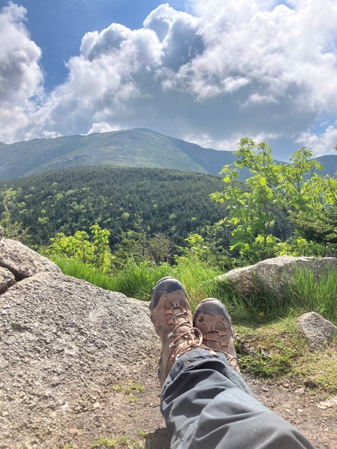
Wednesday, August 6, 2025

Hough Peak, South Dix, Grace Peak and Macomb Mountain, July 28, 2025, Dix Mountain Wilderness, Adirondack Park

Elk Lake from Macomb Mountain Summit

I have never been in any rush to complete all 46 of the ADK high peaks. I've done ones that I like more than once. I spend lots of time on lower-elevation, but equally-rewarding, lower summits. And I consciously choose to avoid a 46er hike if my free day for hiking happens to fall on a day when I know there will be too much pressure. I've also shied away from doing too many hikes that tackle a whole bunch of peaks in one trip and always do them as single day, not overnight jaunts. You don't win the prize for fastest-to-46er that way.

First Glimpse of Hough from Lillian Brook Trail

In 2024, I didn't do a single ADK 46er in the entire calendar year since I spent more hiking time in the White Mountains. For this reason, I decided that I would make up for a big goose egg in 24 by breaking from tradition and doing a single day, multi-peak hike in 25. The Dix Range gives you that option, and on a hot and humid late-July weekday, I planned to do Hough, South Dix, Grace Peak, and Macomb Mountain, in that order, from Elk Lake.

The Beckhorn from Hough Peak

This isn't the traditional way to hit these peaks. Most people tend to go up the west side of Macomb Mountain via the Macomb Slide first, then along the ridge to South Dix and Grace, followed by a backtrack to Hough (and maybe then on to the Beckhorn and Dix). I wanted to avoid the summer crowds so pieced together my own route using the Lillian Brook Trail to access the high elevation and hitting Hough first. This, I reasoned, would also allow me to take my full pack all the way to the Lillian Brook Cut-off, where I could stow it in favor of a lighter summit bag to hit the four peaks, and then, after an out-and-back to Macomb, loop down and back to my pack via the Lillian Brook Cut-off Trail.

View to the West from Gracie to South Dix and Macomb Mountain

The plan was solid and worked a treat, but the conditions made for a much longer and more grueling journey than I had anticipated. First, the trails to these peaks are not official trails, but unmaintained "herd paths." Unmaintained is an understatement. We're talking blow downs galore. It took ages of extra time to clamber over and around the hundreds of tree falls, especially on the disastrous Lillian Brook Cut-off Trail. Secondly, the weather. Near 100% humidity, super warm temps, absolutely no wind even on the high points and the haze of Canada wildfires all contributed equally to an uncomfortable, 10-hour day of soupy slogging over 13+ miles in sweat-soaked clothes.

Nevertheless, the trails were lonely and peaceful, the forests beautiful, and I was pleased to have several of the summits all to myself to admire the amazing views, especially those to the west from the open rocks on Grace Peak and the wide panorama of Elk Lake from Macomb. I'll definitely be back. 

Just not in July.

Peaks: Hough Peak, South Dix, Grace Peak and Macomb Mountain
Elevation: 4,400 feet, 4,075 feet, 4,026 feet, 4,383 feet (Gain: 4,032 feet)
Distance: 13.9 miles roundtrip
Route: Lolipop loop with two out-and-backs (Hunter Pass Trail to Lillian Brook Trail to Dix Range Trail to Grace Peak Trail to Dix Range Trail to Lillian Brook Cut-off Trail to Lillian Brook Trail to Hunter Pass Trail)
Conditions: Mostly sunny, humid, hazy, 80 degrees F
Notable Flora/Fauna: White-Throated Sparrow, Black and White Warbler

Tuesday, June 24, 2025

Mount Lafayette and Mount Lincoln, June 16, 2025, Franconia Range, White Mountain National Forest

View to the South from Franconia Ridge Trail

I've been to Mt. Lafayette many times, with several particularly-memorable hikes being up Falling Waters Trail and another one being a longer loop via the lesser-used Skookumchuck Trail. Since Lafayette is my favorite of the 4,000 Footers, I was excited to find out that both of my nephews had named it as the hike of choice in advance of our most recent trip to the White Mountains. That decision made, all that we needed was a decent forecast. As it turned out we got just that. 

All Smiles on Agony Ridge

It was actually quite lucky that we had such a perfect day - 60s in the valley, 40s up top, no precipiation, and summits in the clear with light and variable winds. The day before our hike was rainy, as was the day after, and we just barely got ahead of a heat and humidity wave that arrived 48 hours later and lasted for a week. The only downside to a good forecast amid a week of unsettled weather is the chance of heavy trail traffic on the most popular peaks. So we resolved to get out as early as possible and were on the trail at 7 a.m. sharp, my brother and I both grumbling that our preferred start time would have been 5 a.m.

View to Lafayette Summit from Greenleaf Hut Nap Spot

We made quick work of the lower, forested reaches of Old Bridle Path and took our first break at one of the numerous rocky ledges along so-called "Agony Ridge" that offer amazing views up to Lafayette and the entire Franconia Range. All of my White Mountain 4,000-Footer hikes with the nephews wind up having catch phrases, which have ranged from the humorous "can you cut the mustard?" to the sullen "this sucks," depending on their moods. For this hike, it was simply "What a Vista!" 

Franconia Ridge Trail, View to the South

What a vista is right. This hike has nothing but great views. The dramatic perspectives up to the top of the ridge as you ascend are only the first. Greenleaf Hut, where we took a break and filled up our water bottles, sits on a prominent pondside point that affords a great view to Lafayette's looming summit cone. After climbing Laffy, we headed south along the Franconia Ridge Trail to Mount Lincoln. This entire route, of course, has amazing views in all directions, making it one of the most popular trails in the White Mountains. At the summit of Little Haystack, we descended into the notch via the Falling Waters Trail, which proved to be equally picturesque since the recent rains had the many namesake waterfalls tumbling in full force.

Lafayette has always been my favorite... even more so now.

Peaks: Mount Lafayette and Mount Lincoln
Elevation: 5,260 feet and 5,089 (Gain: 4,044 feet)
Distance: 8.5 miles
Route: Loop, Old Bridle Path to Franconia Ridge Trail to Falling Waters Trail to Old Bridle Path to 
Conditions: Pleasant and clear, 50 degrees F
Notable Flora and Fauna: Blackpoll Warbler, Blackburnian Warbler, Bicknell's Thrush

Sunday, April 6, 2025

AT and Blue Mountain Trail Loop, April 6, 2025, High Point State Park and Stokes State Forest

View to the west from high point pipeline bushwhack

One of the nicest trails in the Kittatinnys is a relatively newly-cut trail called the Blue Mountain Trail. The problem is that it runs on the edge of a closed-in-winter campground and an environmental school so to get some peace and quiet you need to hike it in the off season. Furthermore, the near 14-mile loop hike that incorporates the Blue Mountain Trail also involves a bushwhack along a pipeline right-of-way. This section has to happen in the cold season. Come spring, the no-mow trace is a tick and bramble haven. Further, the warm weather brings out the rattlesnakes that love to sun on the off-trail rocks found there. Closely monitoring the calendar and the weather forecast during the first week of April, I resolved to use what might be the last cold day of the season to go out and get 'er done.

Shag bark vernal pond on Parker Trail

This hike starts at the Mashipacong Shelter Appalachian Trail parking lot on Deckertown Road. That's a two hour drive, one-way, making it the extreme limit of my in-car time tolerance for a day hike. 13.9 miles on a trail per day is easy; 4 hours in a car is not. I still managed to hit the trail by 7:45 a.m. and started the loop in a counter clockwise direction on the AT. It makes the most sense to do this hike in this direction since it puts the pipeline bushwhack in the early morning -- before the rattlers slither out of their holes. Utility cuts are unsightly scars on the environment and this one is no different. The upside, as birdwatchers know, is that the open land in the middle of dense forest is always a great habitat for our avian friends. There's a nice rocky high point here, too, where I paused for a short break to pull out the binoculars.

Blue Mountain Trail

The reason for the bushwhack is to access the Parker Trail, a lesser-used trail with its northern terminus at the headwaters of Big Flat Brook, which the trail shadows for some distance heading south. Its a nice trail, with a number of pleasant, vernal pools and occasional glimpses of the brook to the east. I took Parker Trail all the way to the campground and my planned destination for the middle of the day - Blue Mountain Trail. The trees on Parker Trail are largely decidous, while those on Blue Mountain Trail are coniferous, which makes the changeover from one trail to the next all the more pleasant in the winter. I hit the 6-mile mark just as I was passing from the stark, barren forest of the Parker Trail into a lush green canopy of Blue Mountain Trail and resolved to take a break to enjoy the scenery. In addition to the pretty conifers, Blue Mountain Trail runs adjacent to picturesque Big Flat Brook. I found a great creekside break spot and took my time relaxing to the sounds of the light rapids.

Blue Mountain Trail break spot on Big Flat Brook

I spent so long at this pleasant spot, in fact, that I forgot that it was a pretty cold day in the mid 30s and got chilled from sitting around. I always have more gear that I need and pulled out a down puffer to warm up before hitting the trail again. This entire section of the hike is along the brook and amid the pleasant pines. Past the New Jersey School of Conservation campus, which was fortunately empty at this time of year, I reached the low point of the hike, elevation-wise, and then turned to the south on the Webster Trail for the long climb back up to the AT. I took a second trailbreak to divide the uphill into two parts and caught a nice sighting of a Red-tailed Hawk careening through the trees just a few feet from where I was resting. All in all, it was a good day for bird sightings and a great day for solitude. Didn't see a single person on the trails and just one car driving along Crigger Road when I was using it as a connector.

View back up to the Kittatinny Ridge and the AT

The only downside of this hike is that the elevation gain is later in the day. I much prefer doing the climbing first thing. But the grade is easy and the footing is good, so it's not that big of a deal. Once up to the AT, of course, I found myself back on the rocks... and the notoriously rocky AT, unfortunately, proved to be the demise of my trusty, 7-year-old Aku hiking boots. One minute, all was good. The next, I felt a flapping on my heel. Sure enough, the entire sole had separated from the uppers. I lashed them together with duct tape (long ago, my brother suggested that I carry it for exactly this purpose) and managed to make it the last 2 miles back to the Mashipacong Shelter and my car just beyond. 

Time to go boot shopping. These boys are done.


Destination: Blue Mountain Trail and Big Flat Brook
Distance: 13.9 miles
Elevation: 1,789 feet (gain)
Route: Loop, AT to Pipeline cut to Parker Trail to Blue Mountain Trail to Swenson Trail to Crigger Road to AT
Conditions: Partly cloudy to partly sunny, 45 degrees F
Notable Flora/Fauna: Red-tailed Hawk, Great Blue Heron, Pileated Woodpecker, Downy Woodpeckers, Red Bellied Woodpeckers, Nut Hatches, and plenty of LBJs of all sorts