Wednesday, September 5, 2018

Table Top Mountain, September 4, 2018, Eastern High Peaks, Adirondack Park

Partial views from Table Top summit
On our July trip to the Adirondacks, I did a fair amount of hiking. But they were shorter, early morning hikes with the dog. The reason: It was HOT... 95, 96 degrees. And HUMID... 98-100%. And the heat wave didn't last a day or two. It was the whole week. Hiking weather it was not. So when we made a second trip later in the season, I figured I was long overdue to add a peak to my 46er list. Since my hiking day of choice had a forecast of summits in the clouds, I chose a peak not really known for its views - Table Top.

The old bridge at Marcy Dam... still under construction?
The hike to Table Top is a very straightforward ascent, rising over fairly moderate gain from the ADK Loj on the trail that goes to Mount Marcy. I hit the trail at 7 AM and made it to Marcy Dam in 45 minutes. From there, the trail follows Phelps Brook for a long stretch, crosses it, and then rises to the turn off for Table Top. I saw a few groups of hikers throughout the day, but all were headed to Marcy.

Phelps Brook foot bridge
The trail to the summit of Table Top is one of those unmaintained ADK "herd paths" but is easy to follow. I stowed my pack in the woods and did a quick up and back to the top. Sure enough, the summit was in and out of the clouds, offering only partial views.

But at least I had it all to myself.

Peak: Table Top Mountain
Elevation: 4,427 feet (Gain: 2,270 feet)
Distance: 9.8 miles round trip, trail time: 4 hours 30 minutes.
Route: Up and back, Van Hoevenberg Trail from ADK Loj to Table Top herd path
Condition: Partly cloudy, 85 degrees F

Monday, September 3, 2018

Nilmah Mountain, September 2, 2018, Adirondack Park

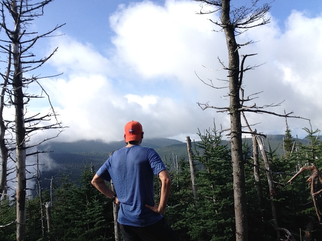
The view south to the High Peaks from Nilmah Summit

The Rock is part dog and part mountain goat. So whenever we are up in the Adirondacks, I like to take him out to bag a few peaks. The short, yet steep hike to the summit of Mount Nilmah provides a good workout and a nice vista point as payoff for a strenuous climb. It's tough for a two-legged human, but no match for a four-legged, high-energy mountain cur.

Nilmah is surrounded by private holdings and therefore inaccessible to the public. To climb it, we always have the proper permissions from the landowners. But in order to prevent others from trespassing without permission, this post uses as pseudonym for the mountain.

The summit, view from the field
From the auto road, the trail follows a wooded path to a open field, then turns right. After a short time on the level, the trail reaches a point where another trail connects from the right. Here, the trail to Nilmah proceeds straight ahead and immediately begins to climb, winding upwards past two small shed-like buildings, until a point where open ledges start to appear through the trees on the right. To get a nice, lower elevation view, go off the trail to the right and scramble up for some vista points.

Rocco on the ledges
At the first sight of the ledges on the right, however, the trail to the summit turns left, drops down, and then turns right and goes up a ravine. It is easy to lose the trail here. To follow it, always stay close to the ravine wall on the right - the trail follows the ravine edge the whole way up the mountain, sometimes following the ravine wall and sometimes going right up it.

Sunrise from the lower ledges, view of Jay Range
The top of Nilmah is flat and wooded with lots of blow-downs, so it is easy to lose one's bearings when getting to the true summit knob. When coming out of the ravine and leveling out, the trail turns to the left and traverses the summit. To reach the high point, look for a trail coming from the left, which goes straight for a short distance and then circles back and to up to the rocky summit knob. If you miss the left turn, the trail will continue and descend the other side of the mountain.

Peak: Nilmah Mountain
Elevation: 2,219 feet (Gain: 1,100 feet)
Distance: 3 miles round trip
Route: Up and Back, blue trail
Conditions: Hot and humid, 90 degrees F

Saturday, July 14, 2018

Elk Pass, July 5, 2018, Eastern High Peaks, Adirondack Park


Elk Pass
At home, we always look forward to the shoulder seasons. Every spring and fall, the big oak and maple trees around our yard emit the mellifluous song of the migrating white-throated sparrows. Once you know it, their sound is unmistakable - "Old Sam, Peabody Peabody Peabody." People north of the border think the birds are saying "My sweet Canada, Canada, Canada." Either way, it's a nice sound.

I'd heard that they spend summers in a high-elevation habitat in the Adirondacks called Elk Pass. So during a recent visit, I decided to make a day hike up to check them out. And maybe also hit a 4,000 footer or two to add to my 46er list.

The Gate House on Lake Road Trail
I arrived at the trail early, as per custom, but found the going incredibly slow due to the near 100 percent humidity and 90+ degree temperatures. From the hiking parking lot at St. Huberts, the route cuts through a private country club to the Lake Road Trail, which rises at a moderate grade until the turn off for the trail to Elk Pass. The trail follows Gill Brook much of the way, providing a reliable water source and a pleasant ambient babble.

Elk Pass proved to be a really stunning and lonely place - a pair of ponds nestled amid the crags of surrounding high peaks that doesn't get near the foot traffic of Avalanche Pass. And, sure enough, as soon as I arrived, the songs of the white-throated sparrows welcomed me to their summer home.

The kingdom of the "Whistlers of the North."
I tried pushing on to Nippletop, one of two neighboring 46ers, but after a false start, decided against it. Elk Pass is a worthy destination in itself.

Destination: Elk Pass
Elevation: 3,335 feet (Gain: 1,550 feet)
Distance: 11 miles round trip
Route: Up and back, Lake Road Trail (25) to Mount Colvin Trail (40) to Elk Pass
Conditions: Sunny, hot and humid, 90 degrees F