Sunday, March 31, 2013

Big Slide, March 30, 2013, Adirondack Park

View to the Southwest, From Big Slide Summit

Like the White Mountains and the Catskills, the Adirondack Park has a goal-oriented hiking club. Known as the Adirondack 46ers, the club is open to those who have hiked all 46 of the 4,000 foot peaks in the Adirondack High Peaks region.

I've been outdooring in the ADKs for years with various trips including peak bagging, canoeing and even the famous "nine carries" canoe route in St. Regis. I guess that I may as well start the ADK 46er list.

First up... Big Slide via the Brothers.

Blue Skies from Big Slide Summit

Big Slide is not one of the highest peaks in the Adirondacks, but it is certainly not an easy one to climb - especially in late March. From the parking area at the Garden in Keene Valley, one travels up and over three smaller peaks - the Brothers - and then steeply up to the summit of Big Slide. I found the trail ice-covered from the start and donned microspikes for the climb over the first two Brothers. Once at a higher elevation, I decided to use snowshoes even though the trail was pretty well packed. It's better wearing 'em than carrying 'em.

View of Big Slide from a Brother

The final push to the top is very steep, but the magnificent views on a bright, blue-skied day proved to be the just reward. As far as I could tell, I was the first on at the summit and had a full 1/2 hour to relax before descending.

The final climb
The descent, however, posed the first real problem of the day. The last section to the summit is super steep, so much so that they installed a wooden "ladder" to help people ascend. Totally snow-covered, the ladder didn't serve me well at all. Instead, the path around it amounted to what looked like a steep bobsled run. I didn't even notice it going up. To descend, I first tried a few cautious steps in snowshoes but the angle just wasn't right. When that didn't work, I tried microspikes. No good either. The warm sun had started a snow melt and it was impossible to get any traction.

Finally, I realized that my best shot at making it home was to butt slide down Big Slide.

Thank goodness for snow pants.

Peak: Big Slide
Elevation: 4,240 feet (Gain: 2,800)
Distance: 8 miles, up and back
Conditions: Sunny, 45 degrees


Saturday, March 30, 2013

Windham High Peak and Windham Redux, March 2 and March 29, 2013, Windham Blackhead Range Wilderness, Catskill Park

Windham High Peak from Escarpment Trailhead
A few weeks back, K and I went up to the Catskill Park for a showshoe ascent of Windham High Peak. A preferred winter peak because of its long, gradual grade perfect for snowshoes, Windham High Peak is one of the Catskill 3,500 footers. Seemed like a good way to add another 3,500 peak to my list, and also give K a chance to try out a day-long jaunt on her showshoes.

Since it was Saturday in the Catskills, we knew that we had better hit the trail pretty early. We decided on the Elm Ridge Trail to the Escarpment Trail, and quickly learned that we were the first peak hikers of the morning. A recent snowfall gave us the added pleasure of breaking the trail in snowshoes.

Hudson Valley, from Windham High Peak Summit
About 1/2 mile below the summit, though, we were overtaken by a party of 20 teenagers and their chaperones - traveling, of course, without snowshoes and post holing all over the pristine trail. Having no desire to join their raucous party on the summit, we turned around... forced to negotiate the awful, mangled trail on the descent.

That's the Catskills...

Blackhead, Black Dome, and Thomas Cole Mtn, from Windham
A few weeks later, I decided to make a return visit and bag the peak once and for all. I arrived around 10:30 AM on a Friday and fortunately found the Escarpment Trail parking lot totally empty. I encountered two hikers near the shelter at the Elm Ridge trail connector, but otherwise had the entire trail - and a prized lunch spot on the summit with views of the Blackhead Range to the south - all to myself.

Peak: Windham High Peak
Elevation: 3,524
Distance: 6.4 miles, up and back
Conditions: Party Cloudy, 40 degrees F

Friday, March 22, 2013

Buttermilk Falls, March 22, 2013, Delaware Water Gap National Recreation Area

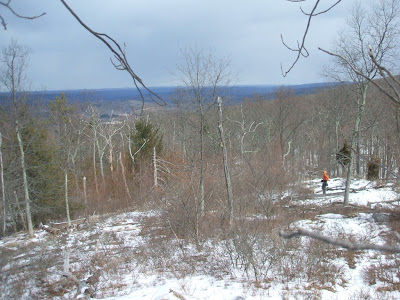
Looking Northwest from the Buttermilk Falls Trail Vista Point
In the summer months, the Delaware Water Gap - our choice for a short day hike - gets intense pressure. So even though it was a cold, overcast Friday during the first week of Spring, we were a little worried of finding crowded trails... especially since we had to first make a two hour drive and would not hit the trail until later morning. As good fortune would have it, however, we saw not a single hiker the entire day.

Our plan called for a lollipop loop up the Buttermilk Falls Trail, connecting to the Appalachian Trail to Rattlesnake Mountain, then to the Woods Road and a final descent back down to Buttermilk Falls. What we didn't count on, however, was a closed NPS gate on Mountain Road leading to the Buttermilk Falls parking area. So instead of parking at the falls, we were forced to park at the Flat Brook parking area 1.7 miles away and hike to the falls from there. As far as I can tell, not a single guidebook or internet post about Buttermilk Falls mentions anything about a gate on Mountain Road. Oh well.

Once we arrived at Buttermilk Falls, we headed up a wooden staircase with two platform overlooks. Next, the trail goes steeply up to a nice picnic spot and vista point with views to the east into the Delaware Water Gap National Recreation Area.

Peak: Buttermilk Falls Vista Point
Elevation: 1,400 feet
Distance: 5.4 miles
Conditions: Cloudy, flurries, 35 degrees F

Not Tired Yet

Buttermilk Falls Stairs

Inaccessible Parking Area