 |
| View to the North from Nippletop Summit |
There are two differing opinions on how to best tackle Nippletop, that mammoth peak to the south of the Great Range with some of the most amazing views in all of the Adirondacks. Having been up at Elk Pass before, I knew that the counter clockwise loop to Nippletop is one long, unrelenting climb, with seriously steep sections from the pass itself up to the summit.
The other route, a clockwise loop using the H.G. Leach Trail, consists of a lot of ups and downs over several other peaks and smaller nubbles before you finally make the push to Nippletop. I really didn't like that super-steep climb from Elk Pass that last time I was up there, so I decided on the up-and-down clockwise loop instead.
 |
| Noonmark through the Trees |
The AMR parking in St. Huberts was totally full when I rolled in a 5:20 a.m., so I got the last spot at Giant Mountain lot across the highway and hit the trail at 5:30 sharp. There were a few parties setting out with dogs and trying to determine what to do when greeted with the huge signs that prohibit them and another party of two just behind me as I moved quickly through the golf course. Fortunately, I left them behind and had the entire approach to Nippletop - 7.2 miles via the H. G. Leach trail - all to myself.
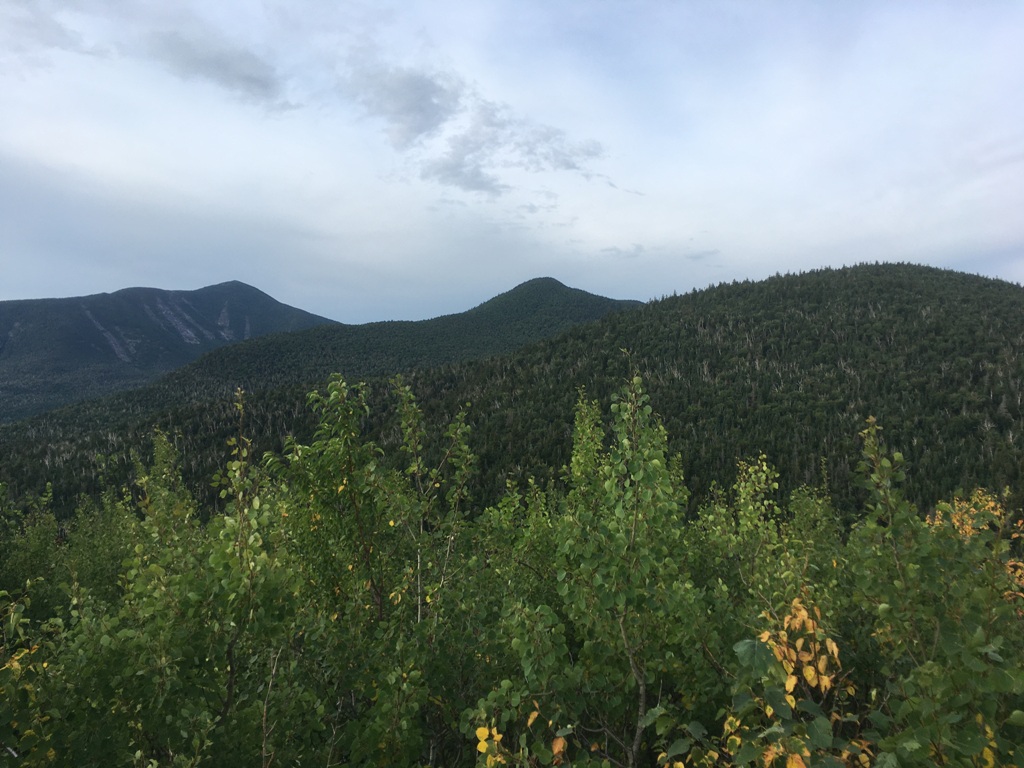 |
| Looking ahead to all three peaks, Bear Den (right), Dial (ctr), and Nippletop (left) |
As expected, there are plenty of ups and downs on the Leach trail. Leaving the gentle Lake Road, the trail does a ton of gradual gain right away and you are rewarded with a nice view through the trees of Noonmark Mountain and then a nice view ahead to all three peaks along the day's route. Nippletop, rising in the far background, is a daunting sight indeed.
It was a long day, for sure, and I needed to take short breaks on the summit of wooded Bear Den Mountain and again at the top of Dial, another 46er peak which awards a nice view north to the full majesty of the Great Range. Then I made the final up-and-down climb to Nippletop, where I needed about a half hour of recovery time before the long, steep descent. Fortunately, I had the summit all to myself.
 |
| View towards Mount Marcy from Nippletop summit rocks |
Following the loop, I next descended to Elk Pass where I started to encounter a few groups heading to Nippletop. Elk Pass itself and its two little ponds was as pleasant as usual, and I took my time meandering through the area before descending via the Mt. Colvin Trail. Although I was trail weary, I decided not to take the first cut off to Lake Road, choosing instead to take the Gill Brook Trail. With its many waterfalls and flumes, Gill Brook is one of the most picturesque trails in the ADKs. It was definitely worth the extra time and effort. I was back at the parking area at 1:30 p.m. Eight hours of trail time. A big day, indeed.
 |
| Along the Gill Brook Trail |
Peaks: Dial and Nippletop (via Bear Den Mountain)
Elevation: 4,020 and 4,620 feet (4,000 feet Gain)
Distance: 14.2 miles round trip
Route: Clockwise Loop, Lake Road, to Henry Goddard Leach Trail, to Mt. Colvin Trail, to Gill Brook Trail, to Lake Road.
Conditions: Sunny, 75 degrees F

