Wednesday, December 12, 2012

Sunfish Pond, December 2, 2012, Worthington State Forest


It's hard to fathom that Sunfish Pond, a higher elevation glacial lake in one of the most beautiful forests in New Jersey, was once in danger of extinction. Forty years ago, power companies had designs on damming the Delaware River at the Water Gap and setting up a mini reservoir system, which would have meant an end to Sunfish Pond. Thankfully, cooler heads prevailed, led by a grassroots New Jersey-based conservation group called the Lenni Lenape League, and Sunfish Pond remains as one of the best day hikes in the entire region.

K and I hiked up to Sunfish Pond - which is located on the Appalachian Trail - on a cold, foggy Sunday morning. In these parts, you HAVE to hit the trail early or risk running into hoards of people - even in the off season. Some parts of the Water Gap region see few hikers. Sunfish Pond is not one of them.

Sunfish Rules

By staying overnight nearby, we were able to hit the trail soon after sun up. Seeing only two cars in the parking lot of I-80 was a harbinger of good things to come. On the way up, we only encountered four hikers - all of whom were going in the opposite direction - and had the trail pretty much to ourselves. The Appalahian Trail here is a gradual ascent up to Sunfish Pond and the early morning fog made for some eerie, yet attractive views into the dense forest. A sighting of a pileated woodpecker bouncing around in and out of the fog was an added bonus.

Appalachian Trail to Sunfish
At the pond, we had the lone bench all to ourselves and broke for a leisurely lunch and thermos of coffee. Not a single hiker arrived at the pond during our lunch break, enhancing the peace and quiet of a special place.

Dunnfield Creek Trail
Although planned as an up and back, we decided to turn our hike into a loop and returned via Dunnfield Creek Trail, aka Dunnfield Hollow Trail, which descends along the creek and requires quite a few fords along the way.

Destination: Sunfish Pond
Distance: 8 miles up and back
Elevation: 1,379 feet Gain: 1,200 feet
Route: Appalachian Trail, Dunnfield Creek Trail
Conditions: Fog, 40 degrees F


Friday, November 9, 2012

Kinsmans, November 4-5, 2012, White Mountain National Forest

View of Franconia Range, from Kinsmans
Knowing that our last hike of this trip would be the Kinsmans - noted for steep, rocky trails - and predicting a continuance of the foul winter weather brought on by the remnants of Hurricane Sandy, we decided to hit Lahout's Outfitters in Lincoln to procure some yak trax.

The spikes saved the day. Although the weather seemed comparatively mild at the Lafayette Campground in Franconia Notch where we left the car, it turned out to be full blown winter on the top of the Kinsmans. We made quick work of the hike up to Lonesome Lake Hut, where we planned to overnight, and then hit the Fishin' Jimmy Trail up to the Kinsmans. Dicey and Icy the entire way, the trail would have been a bear without yak trax or some other form of light traction. We pressed onwards and upwards through light snow. Our ultimate plan was to do both Kinsmans, and then loop over to Cannon Mountain, another 4,000 footer.

Arriving at Lonesome Lake Hut
The plan proved to be way too audacious. Our slower-than-normal pace meant that we'd have to run the risk of not making it back to the hut by dark. No decision needed. We saved Cannon for another day.

So after bagging the Kinsmans - and noting by the absence of tracks that we were once again the first hikers to the peaks - we doubled back to the Kinsman Pond lean-to for lunch, then returned to Lonesome Lake Hut for a cold night in the bunkhouse, with temps hovering around 31 degrees F. Fortunately, Lonesome is one of the huts that runs a wood stove at this time of year. The main building was pretty comfortable, perfect for cooking up a meat and roasted root vegetable dinner with apple cobbler for dessert.

F*%$ Ramen noodles.
A much-needed Balaclava, courtesy of K's wool mastery
The hike was not without misfortune. I double-bent one of my Leki trekking poles, effectively ruining it. But a call to the company several days later resulted in two full sets of replacement sections. It's always nice when a gear company excuses clumsiness.

Peaks: North and South Kinsman
Elevation: 4,293 feet and 4,358 feet (Gain: 3,550 feet)
Distance: 8.4 miles
Route: Lonesome Lake Trail, Cascade Brook Trail, Fishin' Jimmy Trail, Kinsman Ridge Trail
Conditions: Snow, freezing rain, 30 degrees F

Thursday, November 8, 2012

Tripyramids, November 4, 2012, Sandwich Range Wilderness, White Mountain National Forest

The Only Peak Views of the Day, Tripyramids from Pine Bend Brook
Jagged peaks and huge rock slides distinguish the Tripyramids as among the most unique-looking peaks in all the Whites. Unfortunately, we didn't get to see them. Although the rain had subsided, daybreak brought fog and low cloud cover, marring vistas over the entire day. We started the hike at the Sabbaday Falls picnic area, which was closed for construction, forcing us to park on the side of Kancamagus Highway. Sabbaday Brook Trail is noted for its many stream crossings, many of which proved more difficult than expected. But we managed to rock hop without incident.

APC Looking for a Crossing Point on Sabbaday Brook
The trail then cuts due West, around the Fool Killer, a peak that hides the Tripyramids and "fools" the uneducated hiker into thinking it is the final peak. Once around the Fool, it is steeply uphill to the Mt. Tripyramid Trail that runs along the ridge connecting the three peaks - two of which are on the 4,000 footer list. After running south to get the middle peak, we broke out a thermos of DD coffee procured that morning. I'm convinced that winter hikes require that kind of reward.

Middle Tripyramid Summit in Grandpa Hudson's LL Bean Jacket
After a full clothing change, necessary because of spitting precipitation and heavy perspiration from a tough, fast-paced climb, we crossed the north peak and began the descent. Not wanting to repeat the Sabbaday Brook crossings, we took Pine Bend Brook trail down and highway-hiked back to the car.

Winter has arrived, North Tripyramid
Peak: Middle and North Tripyramid
Elevation: 4,140 feet and 4,180 feet (Gain: 3,100 feet)
Distance: 11 mile
Route: Loop, via Sabbaday Brook Trail, Mount Tripyramid Trail, Pine Bend Brook Trail, Road Walk
Conditions: Fog, flurries, 30-35 degrees F

Wednesday, November 7, 2012

Mount Waumbek, November 3, 2012, North Country, White Mountain National Forest

APC and I at the Waumbek Summit Cairn
My brother and I went up Mt. Waumbek five days after Hurricane Sandy made landfall on the Jersey Shore. We had been monitoring the hurricane forecasts, hoping to determine if the weather would impact our planned trip to the Whites. All sources seemed to indicate that the hurricane would continue west, then head north into western New York and break apart.

Although all that turned out to be true, we still caught the residual effects of the storm. Our short, warm-up hike to the top of Waumbek and back was pretty sloppy... Rain at the bottom and light snow at the top. One of the two northern most peaks on the 4,000 footer list, Waumbek's summit is completely tree covered, as is the hike itself, so that afforded some protection from the elements. The trail provided to be one of the easier ascents. There is even a reliable spring along the way.

Trailhead for Mt. Waumbek
We hit the trail early, as is custom, and were the first to the summit. On the way down, though, we passed about 15 people, including a hiker and her partner yammering about how many times they've done the 4,000 footer list... Seems that the crummy weather meant that a lot of folks had the same idea to stay off the higher peaks.

Peak: Mount Waumbek
Elevation: 4,006 feet Gain: 2,700 feet
Distance: 7.2 miles, up and back
Route: Starr King Trail
Conditions: Rain/Snow, 30-35 degrees F

Thursday, October 18, 2012

Monte Mileto, October 7, 2012, Parco Nazionale Della Maiella

Crossing False Summits to Monte Mileto
After nearly two weeks of hardcore hiking, Monte Mileto provided a much-needed respite. Though a 6,000-footer peak hike, the trail follows modest grades the entire way and takes only a half day. After surviving a 12-hour day on the trail a few days before (in which we got lost and nearly ran out of water,) Monte Mileto was just the type of hike that we needed.

Most of the elevation is gained in the car, as the trail head departs from the ski area at Passo San Leonardo, a noted terminus for Maiella hiking trails. In Italy, we rarely encountered other hikers during the week. But Sundays are a different story. Fortunately, the Italian hikers all took a longer, more popular hike along the ridge to Monte Morrone. This left us alone on the ascent to Mileto.

A gradual grade track through a beech forest eventually emerges out of tree line. Cairns then mark the trail up and down several false summits before reaching Mileto proper, which is marked with a cairn and a painted rock with the very faint name and elevation painted on it.

K at False Summit 1, Amaro Range in Distance
From the peak, we expected to be able to see Sulmona but the vista is blocked by topography below the summit. The most dramatic views proved to be to the west, into the heart of the Majella National Park and the towering Amaro Range, the highest in the region.

Mileto summit indicator
Peak: Monte Mileto
Elevation: 1902 meters (6,240 feet)
Route: Up and back, via the recently renamed Q4 trail from Passo San Leonardo  
Distance: 7 km (4.5 miles) miles roundtrip
Conditions: Partly sunny, 55 degrees F


Wednesday, October 17, 2012

Orfento Gorge, October 5, 2012, Parco Nazionale della Maiella

In Caramanico Terme, a town of hotels and hot springs nestled in the center of the Maiella National Park, we enjoyed this short, 3 hour long hike into a gorge of the Orfento River. We found parking on a weekday fairly easily along a side street just south of the centro and walked to the other side of town to the park visitor's center, where one must register to enter the gorge. I guess this is so that they can keep track of unprepared and misguided tourists.


The people at the desk were very friendly and we had a good feeling as we left the building and made our way to the sign marking the entrance to the gorge, or gole. We have found these gorges to be a pretty standard geological feature throughout the Abruzzo.


The trail starts off on the south side of the gorge and consists of a trail along the edge of the mountainside with the river far below. In some places, like here, the trail is loose scree.


Only minutes from downtown Caramanico, the trail takes you into a very peaceful setting with vast vistas into the gorge below and the cliffs on the opposite side. Some points are not for the faint of heart, with steep drops to your left as the trail winds around boulders.


The midpoint for our hike was one of several bridge crossings of the Orfento River - the Ponte Vellone. Other options for trails are possible as indicated on the map of the Maiella National Park issued by Edizioni Il Lupo.


Unlike the first leg of the hike on the cliffs, the return section follows the river along the bottom of the gorge. A nice contrast.


Shadow portrait at the Orfento Gorge.


The return route follows the north side of the river through trees, but from time to time we were rewarded with dramatic views up to the cliffs above. There are a few options for returning to Caramanico. One is to follow this trail to a point where an auto road crosses above. There, the river becomes a spectacular waterfall and a trail leads up to the auto road via steep steps. We cut it short and used our map to find another route up, which led us past a series of pens housing a community of river otters, and back to the information office.

Tuesday, October 16, 2012

Monte Mattone, October 2, 2012, Riserva Naturale Regionale Monte Genzana Alto Gizio

Lunch on Mt. Mattone Summit
Though often overshadowed by the Dolomites, the south-central Italian region of Abruzzo affords splendid opportunities for hiking. K and I had been there before, in 2008, and marveled at the Apennine Mountains - the veritable "spine" of Italy that runs the length of the peninsula and encompasses a series of national and regional parks in Abruzzo. Sans gear, we settled for short walks to trail heads reachable by foot from Sulmona, our base of operations.

For this return trip four years later, we made sure to bring along the requisites needed to fully enjoy this rugged mountain land - boots, packs, poles, topo maps, and, most expensively, a rental car to fully access all of the trail heads.

One of our first peaks: Monte Mattone.

Departing Pettorano Sul Gizio
This hike starts off on a slight grade along an access road from the pretty town of Pettorano Sul Gizio - Gizio being the name of the river that runs below the town and, via an ancient irrigation system, sustains the agricultural pursuits of the entire valley. A pleasant uphill grade through olive groves and alternating along 4x4 tracks and wooded trails eventually emerges on a mountain meadow and the "Il Lago" refugio, an unmanned, no frills hiker's hut completed with a fireplace, picnic table, and fences to keep out the grazing sheep and cattle.

View of Mt. Mattone Summit, from Il Lago Refugio
From Il Lago, the summit of Mattone seemed simple enough to reach... but it took our last bit of pre-lunch energy to make it to the peak.

Il Pranzo alla Cima... Finalmente
The most difficult part of this hike, however, was the descent. For one, the open meadow below the summit had no cairns... Once we found it, the trail proved to be a steeply-pitched mule track, washed out at several points by scree falls and littered with pine cones that made footing unsteady. Once off the mountain, though, the trail becomes a pleasant stroll along the headwaters of the Gizio, past an old church, and back into Pettorano Sul Gizio.

Trail Marker for Il Lago
We had designs on being back in town for lunch at Il Torchio, a highly-lauded local restaurant in Pettorano. Thanks to a serious problem with guidebook that we used to find the hike, we underestimated the hiking time by 4 hours.

Peak: Monte Mattone
Elevation: 1,306 meters (4,285 feet) 
Gain: 900 meters (2,952 feet)
Distance: 12 km, 7.5 miles
Conditions: Sunny, 60 degrees F


Monday, October 15, 2012

Santo Stefano di Sessanio to Madonna della Pieta, October 1, 2012, Parco Nazionale del Gran Sasso

Located on the edge of the Camp Imperatore wilderness, a high elevation plain within the Gran Sasso National Park, Santo Stefano di Sessanio is a picturesque little hill town that serves as a great starting point for this moderate, 10 km loop hike with dramatic, sweeping vistas in all directions. Though relatively short with little elevation gain, it turned out to be one of our favorite hikes of the trip.


From a parking spot in the town center, we walked out of town through the pleasant wooded park seen above and then made our way up to a hill marked with a cross, or croce. We used the book, Walking in Abruzzo and the Gran Sasso park map by Edizioni Il Lupo as our guides.


From the cross, the route heads due east across open hillsides. From time to time, we came across red and white markers signifying a marked trail but one doesn't appear on the Gran Sasso park map. One of the many times when there was a disconnect between what is written and what is reality.


After reaching a low point and crossing a dirt 4x4 road, the trail ascends on a slight grade along a barbed wire fence and then increases in steepness. We started out on the north side of the fence, and at a break in the fence switched over to the south side as per the beaten path.


Skirting the hillside on a noticeable track heading east, we found a nice cluster of rocks that made for a great snack spot with wide open views to the south, east, and west.


Markings along the way were sporadic at best. Here, we encountered a very informational trail sign... the trail names and numbers were either never added or beaten off by the harsh weather of the Campo. In the distance are several stone enclosures used by shepherds to corral their flocks.


Our final destination for the day turned out to be the Madonna della Pieta Church seen here on the right. Most people come to the area to see the castle, Rocca Calascio, in the background. By the time that we arrived, however, several hiking parties were making their way up to the castle so we decided to leave it for another time and head back. The hike had already made enough of an impression that we knew that we would return.


In order to effect a loop hike, we followed a 4x4 track into the valley on the north side of the hills that we had crossed on the way to the church. The gentle grade and crushed stone made for easy walking.


Growing weary, we decided on a short cut back into town and took the auto road. Not recommended. Although traffic was light, any cars that passed did so a a breakneck speed and with little familiarity with hikers. We made it back to town just a half hour or so too late for lunch at the one restaurant in town. A shame... the town is known for its lentils! Gusto!


Sunday, October 14, 2012

Fonte Pacile, September 28, 2012, Sulmona, Italy

Fonte Pacile, view to the west, with trail marker
Conveniently located just outside of Sulmona, the hike to Fonte Pacile turned out to be quite memorable. It's a fairly easy climb over moderate elevation gain that leads up to a fully functioning old spring, or fountain, nestled in the rolling hills east of the Sulmona cemetery. It's a truly pleasant spot, which we reached in time to have some snacks that we had brought along for a planned half-day of hiking. After the break, we decided to press on to try to complete a loop back to the cemetery parking area as indicated on our map of the Riserva Monte Genzana Alto Gizio, a protected regional natural area located close by that also showed our proposed route.

On the trail to Fonte Pacile, view to the east
Bad idea. Once we went up another 100 or so meters in elevation, the trail made a long descent back down into the valley. According to our map, the trail would then turn back to the west at a second fountain. We found the fountain (which was dead) but the land due west of it was now a recently plowed field. A little further ahead, we eventually found a trail heading in the direction that we needed to go, but it took us to a series of dead ends like fenced private properties, homes guarded by filthy ditch dogs, and natural barriers like bramble patches and steep slopes. We were clearly lost.

K scouting a trail
Having no other option, we retraced our steps back up to the hills. Out of water and nearly out of food, Fonte Pacile provided a much-needed (life-saving) respite once again. We took a long break to drink and fill our bottles and were rewarded with a view of a shepherd with his flock on the hill across from us. Well rested and rehydrated, we pushed back to the cemetery just as the last light of the afternoon was fading to dusk.

Tante Grazie, Fonte Pacile.

The start and end of the trail to Fonte Pacile, from the Sulmona Cimitero
Destination: Fonte Pacile
Distance: 16 km round trip (9.9 miles)
Elevation: 988 meters (3,241 feet)
Gain: 862 meters (2,828 feet)
Conditions: Party Cloudy, 75 degrees F


Saturday, October 13, 2012

Sagittario Gorge, September 27, 2012, Riserva Naturale Regionale Monte Genzana Alto Gizio

Located just to the west of the Monte Genzana Alto Gizio Nature Reserve, this 6 km hike covering 370 meters (1,200 feet) of elevation gain connects two beautiful Italian hill towns (Anversi degli Abruzzi and Castrovalva) and returns via a spectacular gorge complete with towering walls, a river torrent, and plenty of flora and fauna. We can thank the book, Walking in Abruzzo, for pointing out this hike to us.


To start, a little advance research helped us to find a better place to park than the book recommends. Before getting to Anversa proper, a left hand turn past what looks like a large water treatment building takes you down to a car park next to the entrance of the botanical garden where the hike begins.


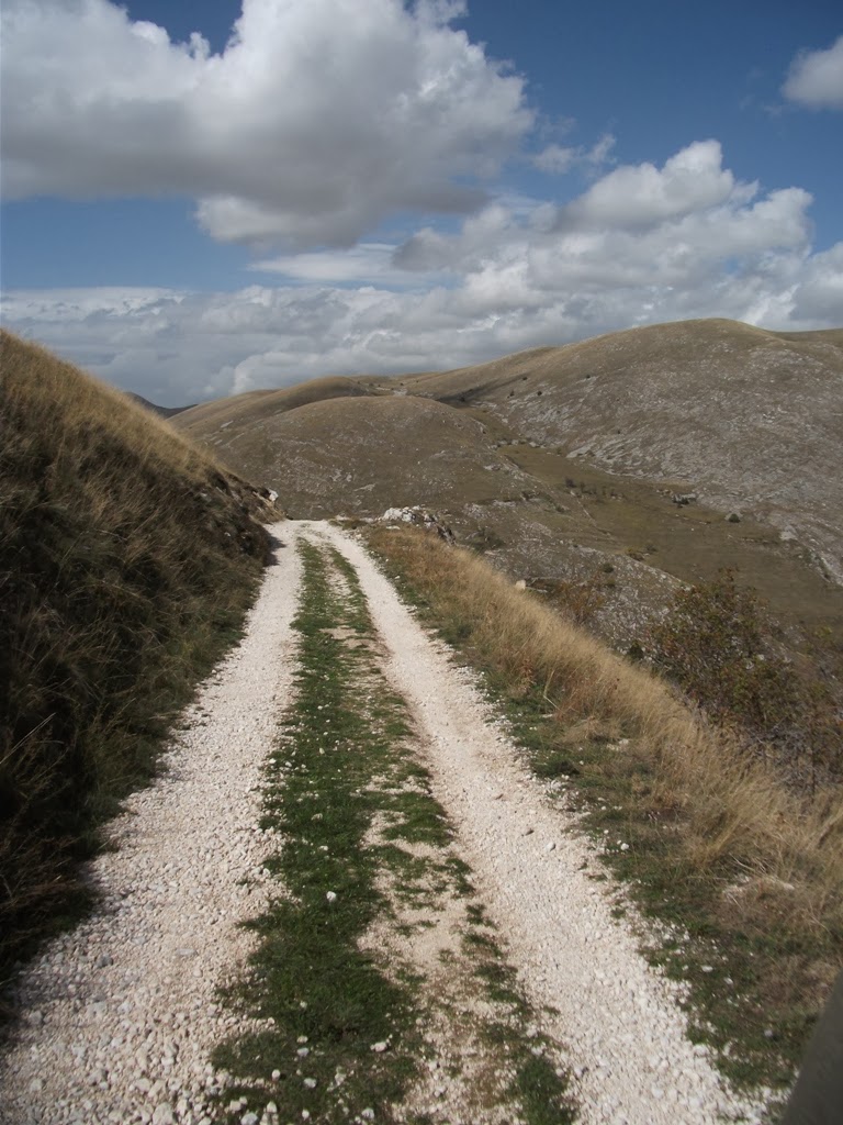
The first and only climb of the hike took us up to a point with great views looking back on Anversi degli Abruzzi. On the way, we received the good wishes of a gardener who left us with a friendly warning to be careful of cinghiali, wild boars that live in the area and are a delicacy on the dinner table here.


After the climb, the trail draws level in elevation with Castovalva. Here's our first glimpse of the picturesque town from across a steep ravine. M.C. Escher used as a model for one of his famous illustrations.


The route then heads into Castrovalva proper, which is perched high on a precipice overlooking the Sagittario River gorge and Anversi degli Abruzzi. A short detour takes you out to the Chiesa di San Michele, a church that sits on the furthest point outside of town and is surrounded by cliffs on three sides.


The descent route from Castrovalva into the gorge, or gole, of the River Sagittario, utilizes stone steps, dirt trails, and the auto road. The entrance to the gorge is marked at an intersection of the road with another main road to Scanno.


Leaving the auto road, the trail into the gorge offers a full canopy of tree cover. We encountered interpretive signage and warnings to heed the rock falls as well as numbered stations along a "geological trail." Basically, the trail that we were following back towards Anversa doubles as a geological route out of Anversa... a little confusing, but we figured it out.


The Sagittario River - really not much more than a stream - races through the gorge at a fast clip, but in parts it also forms slow moving pools with beautiful green mosses and other aquatic plant life. Nearing Anversa, it is diverted into a channel for the town's water supply.


The route through the gorge was extremely peaceful. We encountered not a single person and enjoyed the sounds of birds and rushing water. Numerous bridge crossings and glimpses through the canopy of the towering cliffs on both sides added to the experience of a really special place.